Galapagos Islands National Park
General Information
UUID
09f9268e-0150-4e0e-aafd-8cee5c7562b4
Location Type
Description
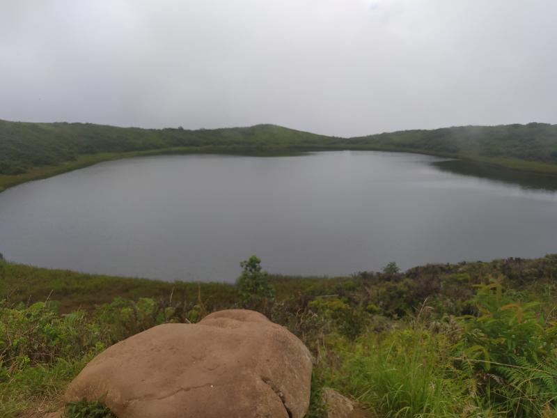
The ILTER site includes continental aquatic ecosystems and watersheds, terrestrial ecosystems and marine areas.
The prevailing arid condition in Galapagos is sustained by the synergic interaction of the cold and dry air and the trade winds (Colinvaux, 1984). The seasonality is marked by a warm season, occurring between January and May, with convective rainfall and high temperatures (Trueman and d’Ozouville 2010, Schmitt et al. 2018). The cold season occurs between June to December, characterized by mist conditions in the highlands and low temperatures (Trueman and d’Ozouville 2010, Schmitt et al. 2018). These features are still the most notable of Galapagos climate, along with the formidable periodic influence of hot, wet El Niño years and their dry La Niña counterpart (Snell and Rea 1999). However, the thermal anomalies associated with El Niño occurrence seem to have worsened during the last 20 years (Wolter and Timlin 1998), with an increase in sea-surface temperatures, increased rainfall, and potential occurrence of subsequent extreme droughts, associated with La Niña (Snell and Rea 1999). The climatic zonation in the Galapagos Islands is characterized by humid highlands, dry lowlands, and a transition zone and these zones are especially observed in islands of intermediate height such as Santa Cruz, San Cristobal, Floreana and Santiago (Trueman and Ozouville 2010). In the larger and higher islands, the dry uplands may be observed, with marked differences of the vegetation pattern between lowland (semi-arid) and highlands (humid vegetation) (Trueman and Ozouville 2010). However, the vegetation has been drastically altered over time due to human pressure (Tye et al. 2002, Tye 2008, Watson et al. 2009). Among the Galapagos islands, Floreana, Isabela, San Cristobal and Santa Cruz are inhabited according to the rules established to limit the human occupation to 3% of the total area (Guézou et al. 2010). The most populous islands, Santa Cruz and San Cristobál have registered an increase in population since the 1970s (Guézou et al. 2010).
The prevailing arid condition in Galapagos is sustained by the synergic interaction of the cold and dry air and the trade winds (Colinvaux, 1984). The seasonality is marked by a warm season, occurring between January and May, with convective rainfall and high temperatures (Trueman and d’Ozouville 2010, Schmitt et al. 2018). The cold season occurs between June to December, characterized by mist conditions in the highlands and low temperatures (Trueman and d’Ozouville 2010, Schmitt et al. 2018). These features are still the most notable of Galapagos climate, along with the formidable periodic influence of hot, wet El Niño years and their dry La Niña counterpart (Snell and Rea 1999). However, the thermal anomalies associated with El Niño occurrence seem to have worsened during the last 20 years (Wolter and Timlin 1998), with an increase in sea-surface temperatures, increased rainfall, and potential occurrence of subsequent extreme droughts, associated with La Niña (Snell and Rea 1999). The climatic zonation in the Galapagos Islands is characterized by humid highlands, dry lowlands, and a transition zone and these zones are especially observed in islands of intermediate height such as Santa Cruz, San Cristobal, Floreana and Santiago (Trueman and Ozouville 2010). In the larger and higher islands, the dry uplands may be observed, with marked differences of the vegetation pattern between lowland (semi-arid) and highlands (humid vegetation) (Trueman and Ozouville 2010). However, the vegetation has been drastically altered over time due to human pressure (Tye et al. 2002, Tye 2008, Watson et al. 2009). Among the Galapagos islands, Floreana, Isabela, San Cristobal and Santa Cruz are inhabited according to the rules established to limit the human occupation to 3% of the total area (Guézou et al. 2010). The most populous islands, Santa Cruz and San Cristobál have registered an increase in population since the 1970s (Guézou et al. 2010).