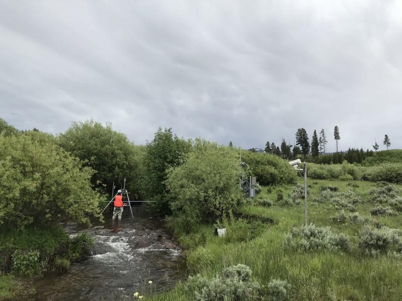
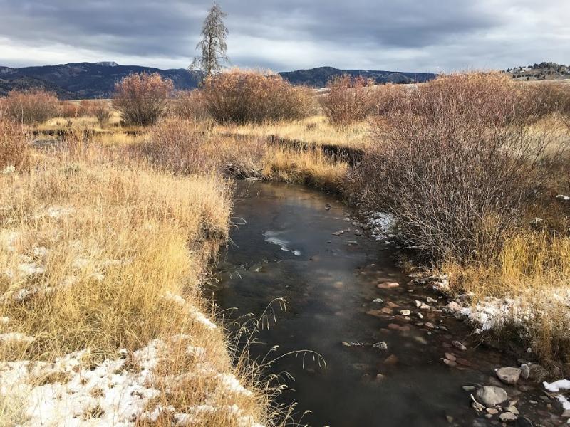
Blacktail Deer Creek NEON - United States of America

Basic Information
Platform Icon

Site Name
Blacktail Deer Creek NEON
Short name
BLDE
Country
United States of America
Site Manager
Site Description
Blacktail Deer Creek is a core aquatic site within NEON's Domain 12: Northern Rockies. Blacktail Deer Creek is a small, fast freshwater stream in the Blacktail Deer Plateau. It supports trout, pike and other game species. Blacktail Deer Creek (BLDE) is located in the Northern Range of Yellowstone National Park just south of the Montana-Wyoming state line. It is a wadeable stream aquatic site covering a 1000-m reach of Blacktail Deer Creek, one of several creeks and streams running through the Blacktail Deer Plateau at the northern edge of the park. It is part of a watershed area encompassing 35 km2 (13.5 square miles) of the Northern Range. BLDE is located just two miles from NEON's Yellowstone Northern Range/Frog Rock (YELL) terrestrial site. The sites are easily accessed from Yellowstone's Grand Loop Road. The site is a ¾-mile off-trail hike from the Frog Rock gravel pit, where the park stores gravel for maintenance of roads and trails. The land outside the park is sparsely populated. The nearest communities (Gardiner, population 875, and Cooke City, population 150) are located in Montana on the northern border of the park. This site has one meteorological station located in the riparian area and one meteorological station above water on a buoy. The met stations are outfitted with the a subset of the same sensors used at terrestrial sites. Measurements include wind speed and direction, air temperature, barometric pressure, relative humidity, shortwave radiation, and PAR.Remote sensing surveys of this site collect lidar, spectrometer and high resolution RGB camera data. Seven groundwater wells throughout the site collect specific conductivity, water tempertaure, and elevation of groundwater. This site has one buoy-mounted sensor station and an inlet station and outlet station. At the buoy, the automated instrument measurements are: PAR at water surface, PAR below water surface, temperature at a specific depth in surface water, water quality (specific conductivity, chlorophyll a, dissolved oxygen content, pH turbidity, and fDOM), and nitrate. At the inlet and outlet stations, the measurements are: PAR below water surface, elevation of surface water, and temperature in surface water. Field ecologists collect the following types of observational data at this site: aquatic organisms (Aquatic Microbes (surface water), macroinvertebratesmicroalgae, plants and macroalgae, zooplankton. Biogeochemical data on plants,sediment water and particulates. As well as physical aquatic data on bathymetric maps, stage,secchi depth and depth profiles, and riparian assessment.
Last modified
2020-07-27 10:07:45

CC-BY-NC Logo

General Characteristics and Status
Site Status
Operational
Year Established
2018
Observed properties
Affiliation and Network Specific Information
Affiliation
GERIThis site is a verified "GERI" member.
NEON (BLDE)This site is a verified "NEON" member.
Photos
Discharge sampling at BLDE
Blacktail Creek in October
Geographic
Elevation (average)
2053.00msl
Elevation (min)
1847.00msl
Elevation (max)
2244.00msl
Download

Site information [.json]

Centroid/representative coordinates [.shp] [.kml]