LTSER Platform Oberes Paznaun - Austria

Basic Information
Platform Icon

Site Name
LTSER Platform Oberes Paznaun
Short name
Platform Oberes Paznaun
Country
Austria
Site Manager
Site Description
The LTSER platform Oberes Paznaun includes the communities of Ischgl and Galtür (225 km²), and covers an elevation range from 1263 to 3384 m.a.sl.. The village of Galtür is one of the highest permanently inhabited places in the Alps. Fluchthorn, the highest peak of the largely glacier-covered Silvretta, was taken down by about 30m in 2023, when a major rock fall occurred as a result of reducing permafrost. Both the effects of climate and those of land use change affect the very sensitive livelihoods in the are, exposed as they are to natural hazards, such as avalanches, rock fall and floods. The region was economically weak until winter tourism boomed from the 1970s. Skiing as dominant source of income now has an impact on land ...
Show more ...
Last modified
2024-05-07 08:05:55

CC-BY-NC Logo

General Characteristics and Status
Site Status
Planned
Year Established
2024
Observed properties
atmospheric parameterwater parameterecosystem parameterlandscape parameterchemical parameterenvironmental parameterremote sensing parameteragricultural parameterbiological parametergenetic parameterphysical parameterairhumidityairspecifichumidityairtemperatureatmosphericpressuredaylightlengthdewpointdiffuseradiationintensitydiffusereflectancediffusesolarradiationintensitydirectradiationintensityfrostpointglobalradiationirradianceheatfluxincomingradiationintensitylongwaveradiationmaximumtemperaturemeanannualairtemperaturemeanannualprecipitationmeanannualtemperatureminimumtemperaturenetfarinfraredradiationirradiancenetradiationirradiancenetsolarradiationirradianceprecipitationintensityreflectedglobalradiationirradiancereflectedradiationintensityrelativehumiditysnowdepthsnowwaterequivalentsolarradiationsunshinedurationtotalradiationirradiancevaporpressurewinddirectionwinddirection(meanandgust)windspeedwindspeed(meanandgust)ammoniumnitrateconcentrationammoniumnitrogencontentavailablephosphoruscarbondioxideconcentrationconductivitydissolvedorganiccarboninwaterdissolvedorganicnitrogendissolvedorganicphosphorusrainfallvariabilityrivertemperaturerunoffamountsedimentationratesnowcoversnowdepthsnowwaterequivalentsurfacerunoffwaterdepthwaterlevelwaterqualitywatersalinitywatertemperaturewatervolumefloristiccompositionforestcoverheatflowlandcovertypelatentheatplantcoverplantdensityplantdistributionplantdiversityplantspeciesabundanceplantspeciescompositionplantspeciespresenceplantspeciesrichnesspopulationchangesovertimepopulationdensitypopulationsizespecieslisttreeagevegetationpatternlandcoverlanduselanduseintensitylandusepatternlandscapecompositionlandscapeconfigurationlandscapeconnectivitylandscapefragmentationlandscapeheterogeneitylandscapemetricslandscapepatternlandscapestructurepatchdensitypatchsizesurfaceareachemicalcompositionchemicalcompositionofwaterpHvalueofwateraltitudinalgradientlandsurfacetemperaturesnowdepthalbedosoilalbedovegetationreflectancesurfaceairtemperaturebiologicaldiversityDNAsequencecanopyheight
Affiliation and Network Specific Information
Affiliation
Global Cryosphere Watch (GCW) (148)The affiliation of this site with "Global Cryosphere Watch (GCW)" is not verified by the network on DEIMS-SDR.
World Glacier Monitoring Service (WGMS) (WGMS_ID:480)The affiliation of this site with "World Glacier Monitoring Service (WGMS)" is not verified by the network on DEIMS-SDR.
LTER Austria (LTER_EU_AT_014)The affiliation of this site with "LTER Austria" is not verified by the network on DEIMS-SDR.
Projects
Photos
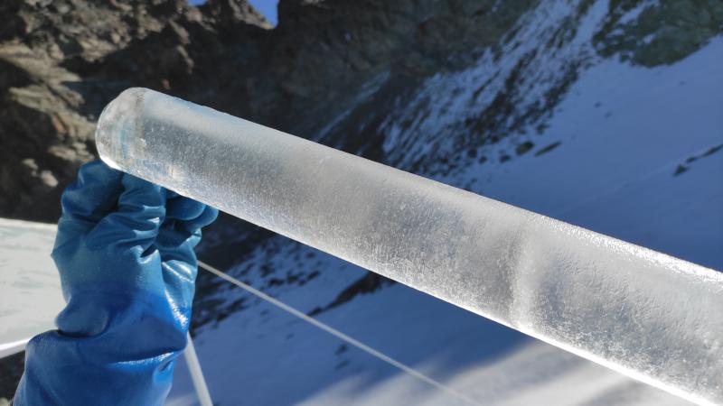
Jamtalferner
Jamtalferner
Geographic
10 km
5 mi
Sites are only displayed in the site overview map when they have set an active site status.
Centroid/Representative Coordinates

Latitude: 46.877771 Longitude: 10.168362

Size
ca. 22520.00ha
Elevation (average)
2279.00msl
Elevation (min)
1263.00msl
Elevation (max)
3381.00msl
Download
Site information [.json]

Centroid/representative coordinates [.shp] [.kml]
Bounding Box [.shp] [.kml]
Boundaries [.shp] [.kml]