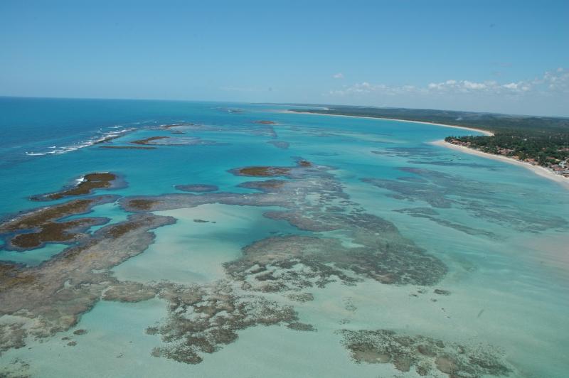
Tamandaré Coastal-Marine Complex, APA Costa dos Corais - Brazil

Basic Information
Site Name
Tamandaré Coastal-Marine Complex, APA Costa dos Corais
Short name
TAMS
Country
Brazil
Site Manager
Site Description
The Site is located on the northeast Brazilian coast, East Brazil LME, and includes the seascape extending from the coast to the continental slope. The coastal area is formed by an ecosystem complex including remnantes of Atlantic forest, mangroves, seagrass beds and coraline reefs. These ecosystems are interconnected along the seascape over the typically carbonatic shelf, with widths around 18 nautical miles. Along the shelf, submerged channels related to continental drainage in glacial periods, and submerged reefs, form habitats responsible for supporting resources exploited by intense fishing activity. The outermost portion of the continental shelf, considered as an area of significant biological and ecological interest (EBSA), is a biodiversity hotspot, home to reef fish spawning aggregations, and higher fish yield associated with evidence of sub-surface upwellings. These seascape support complex ecological processes, subject to intense use, in an area recognized as a priority for conservation. The presence of Marine Protected Areas reflects this characteristic, both for the need to protect these environments, and for the socio-economic importance, with two protected areas for sustainable use (APAs) and one for Integrated Protection (Park), organized in mosaic.
Last modified
2020-06-29 01:06:40

CC-BY-NC Logo

General Characteristics and Status
Site Status
Operational
Year Established
1997
Observed properties
Affiliation and Network Specific Information
Affiliation
LTER Brazil (LTER_SAM_BR_18)The affiliation of this site with "LTER Brazil" is not verified by the network on DEIMS-SDR.
Photos
Coastal Reefs of Tamandaré, Pernambuco State, Brazil.
Geographic
Centroid/Representative Coordinates

Latitude: -8.771 Longitude: -35.091

Elevation (average)
-20.00msl
Elevation (min)
-100.00msl
Elevation (max)
10.00msl
Download

Site information [.json]

Centroid/representative coordinates [.shp] [.kml]
Bounding Box [.shp] [.kml]
Boundaries [.shp] [.kml]