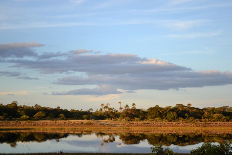
Veredas of Minas Gerais: local anthropogenic effects and global climate change - Brazil

Basic Information
Site Name
Veredas of Minas Gerais: local anthropogenic effects and global climate change
Short name
PELD-Veredas
Country
Brazil
Site Manager
Site Description
The PELD-VERE research site comprises three Conservation Units (UC): State Park of Veredas Peruaçu (PEVP), Environmental Protection Area of Pandeiros River (APA Rio Pandeiros) and Private Natural Reserve of Porto Cajueiro (RPPN Porto Cajueiro ). These UCs are located in the north of Minas Gerais, with the PEVP in the municipality of Cônego Marinho, APA Rio Pandeiros in the municipalities of Januária, Bonito de Minas and Cônego Marinho and RPPN Porto Cajueiro in Januária. These Ucs are very close to each other and are part of the Sertão Veredas-Peruaçu Mosaic. This mosaic, located on the left bank of the São Francisco River, covers the north and northwestern macroregions of Minas Gerais and a small part of the southwestern of Bahia and integrations of both protected and sustainable use conservations units, totaling more than 1,500,000 ha (FUNATURA 2008). The municipalities that make up the study site present tropical climate with dry winter, Aw of Köppen, with averages of temperature of 22.2º C to 22.7º C and average annual rainfall of 1008 to 1073 mm. Geomorphologically, the region forms part of the San Francisco Depression and San Francisco Plateau. The environmental conditions of the region are the result of a geological process based on the removal of sedimentary material occurring during the Tertiary period (Urucuia and Santa Helena Formations) and consequent exposure of the limestone layers of the Bambuí Series, monthly Pre-Cambrian remodeling. The soils of the region are usually sandy, unstructured, deep and with high drainage. Its origin comes from the transport and the sedimentation of material carried by great water flow in past geological periods. These conditions determined a soil that is poor in nutrients, very acidic and devoid of organic matter. The selection of areas is premised on the allocation of sample units in different environments, in relation to a current hydric situation and associated landscapes, all within the same climatic region. Thus, an area 1 will be located the PEVP, where it will be studied the Peruaçu Vereda (14º56'13 "S and 44º37'44" W), an environment that has drying over the years and is located in a protected area. The Area 2 will be located at APA Rio Pandeiros, in the Almescla Vereda (15º22'50 "S and 44º55'28" W), with loss of springs, and is inserted in a landscape with diverse antropic activities. Lastly, Area 3 will be located at the Porto Cajueiro RPPN (14º53'18 "S and 45º20'31" W), which does not change its watercourse and is inserted in a protected area. In this sense, three environments, such as subject to different local water conditions will be considered: two presented watercourse drying, but in different landscapes (preserved and impacted) and one a control environment, without severe disturbance.
Last modified
2020-06-29 10:06:05

CC-BY-NC Logo

General Characteristics and Status
Site Status
Operational
Year Established
2016
Observed properties
Affiliation and Network Specific Information
Affiliation
LTER Brazil (PELD-VERE)The affiliation of this site with "LTER Brazil" is not verified by the network on DEIMS-SDR.
Photos
not defined
not defined
not defined
not defined
not defined
not defined
not defined
not defined
Geographic
Elevation (average)
704.00msl
Elevation (min)
562.00msl
Elevation (max)
757.00msl
Download

Site information [.json]

Centroid/representative coordinates [.shp] [.kml]