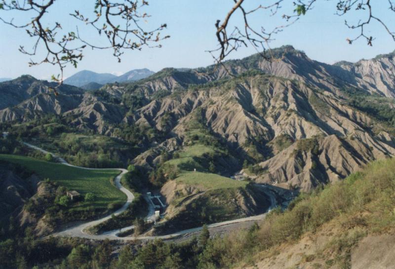
OZCAR-RI Draix-Bleone observatory Draix site - France

Basic Information
Site Name
OZCAR-RI Draix-Bleone observatory Draix site
Short name
Draix
Country
France
Site Manager
Site Description
Draix site is part of Draix-Bleone observatory, located in the French South Alps, upstream of Digne, on the left side of the Bleone. Draix site was equipped in 1983 to study mountain erosion and sediment transport. It is composed of 4 catchments, which are equipped to measure water and sediment fluxes, at spatial scales ranging from 0.001 km2 to 1 km2, with contrasted land cover. These catchments are entirely situated on black marls that are very sensitive to weathering and erosion, resulting into a badland topography. One catchment was reforested at the end of the XIXth century whereas the other are mostly denuded. This site is characterized by intense erosion and intermittent sediment fluxes. The variables that are monitored on the long-term include rainfall and meteorology, high-frequency water discharge and suspended sediment concentration (1-10 minutes), event-scale bedload transport, and some physico-chemical properties of stream water and sediments.
Last modified
2024-04-19 04:04:22

CC-BY-NC Logo

General Characteristics and Status
Site Status
Operational
Year Established
1983
Observed properties
Affiliation and Network Specific Information
Affiliation
OZCAR RIThe affiliation of this site with "OZCAR RI" is not verified by the network on DEIMS-SDR.
LTER FranceThe affiliation of this site with "LTER France" is not verified by the network on DEIMS-SDR.
Photos
Draix badlands
Draix badlands
Laval hydrosedimentary station
Laval catchment
Laval catchment
Geographic
Centroid/Representative Coordinates

Latitude: 44.140206 Longitude: 6.360505

Elevation (average)
1000.00msl
Elevation (min)
850.00msl
Elevation (max)
1200.00msl
Download

Site information [.json]

Centroid/representative coordinates [.shp] [.kml]
Bounding Box [.shp] [.kml]
Boundaries [.shp] [.kml]