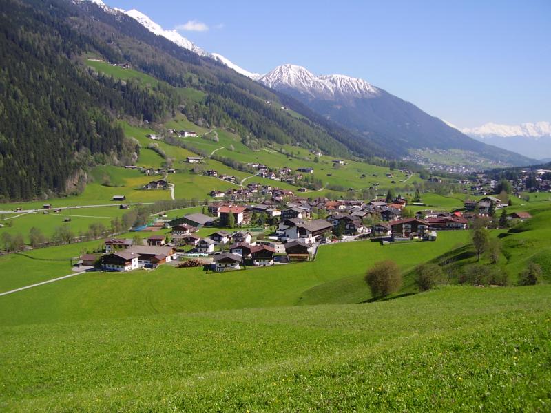
Stubai (combination of Neustift meadows and Kaserstattalm) - Austria

Basic Information
Site Name
Stubai (combination of Neustift meadows and Kaserstattalm)
Short name
Stubai
Country
Austria
Site Description
The LTER grassland sites in the Stubai Valley are situated near the village of Neustift (47° 7′ N, 11° 18′ E). They include a valley bottom meadow at 970 m a.s.l., cut 3-4 times per year, as well as three grasslands differing in land use, which are located on the mountain slope in the vicinity of the Kaserstattalm: a mountain meadow at 1810 m a.s.l. (one cut, lightly grazed in late summer), a pasture at 1870 m a.s.l. and a grassland at 1980 m a.s.l., which was abandoned in 1984. Documentation of management history and vegetation dynamics of the whole area date back to 1865, and detailed information on the current socio-economic situation and future land-use scenarios is available.
Last modified
2023-07-25 10:07:05

CC-BY-NC Logo

General Characteristics and Status
Site Status
Operational
Year Established
1999
Affiliation and Network Specific Information
Affiliation
ILTERThis site is a verified "ILTER" member.
LTER EuropeThis site is a verified "LTER Europe" member.
LTER Austria (LTER_EU_AT_015)This site is a verified "LTER Austria" member.
Photos
Overview of the LTER site with the meadows at the valley bottom and the research areas in the vicinity of the Kaserstattalm on the slopes close to the timberline. Picture taken from the counter slope
Weather station in the grassland at the Kaserstattalm
Part of the village of Neustift at the bottom of the Stubai valley
Geographic
Centroid/Representative Coordinates

Latitude: 47.1167 Longitude: 11.3

Elevation (average)
2000.00msl
Elevation (min)
970.00msl
Elevation (max)
2500.00msl
Download

Site information [.json]

Centroid/representative coordinates [.shp] [.kml]
Bounding Box [.shp] [.kml]
Boundaries [.shp] [.kml]