Lautaret - Roche Noire - France

Basic Information
Site Name
Lautaret - Roche Noire
Short name
Lautaret-Roche-Noire
Country
France
Operating Organisation
Site Description
The research station of Lautaret Garden is a set of infrastructures and human resources at the service of alpine environmental research, spread over two sites open all year round. One is located on the campus of the University Grenoble Alpes (dept 38), it is divided into greenhouses, arboretum, experimental zone. The other is located at the Lautaret pass (dept 05) at an altitude of 2100m. The site of altitude gathers an Alpine Botanical Garden, three buildings, an experimental zone and natural area. This structure provides field support for scientific projects, two laboratories, accommodation for 46 people, hydrology and climate data and also botanical expertise. It organizes, in its multimedia room and meeting rooms, trainings, thematic schools, conferences, seminars. The research themes developed mainly concern the ecology of environments in relation to climate, socio-ecosystems, adaptation of living organisms, the physical environment and biogeochemical cycles. Some projects have been carried out since 1980, others operate on a multi-year basis. The station also welcomes foreign researchers within the framework of the Transnational access.
Last modified
2024-04-22 11:04:26

CC-BY-NC Logo

General Characteristics and Status
Site Status
Operational
Year Established
1980
Observed properties
Affiliation and Network Specific Information
Affiliation
LTER EuropeThis site is a verified "LTER Europe" member.
ICOS (https://meta.icos-cp.eu/resources/stations/ES_FR-CLt)The affiliation of this site with "ICOS" is not verified by the network on DEIMS-SDR.
AnaEE (https://isia.cnrs.fr/platform/read/8)The affiliation of this site with "AnaEE" is not verified by the network on DEIMS-SDR.
LTER FranceThis site is a verified "LTER France" member.
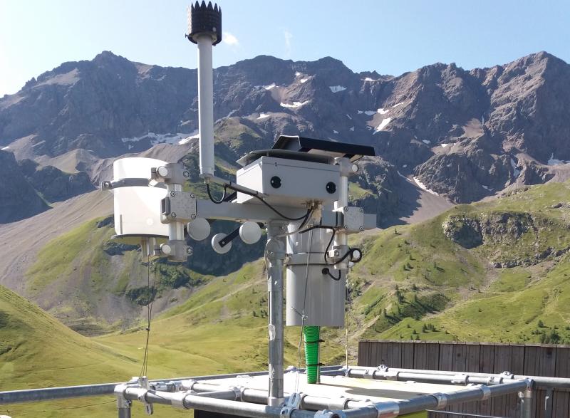
Photos
Winter maintenance on the measurement tower (2020 © Lautaret research station)
Lautaret-Roche-Noire catchment photo from time-lapse (2023 © Lautaret research station)
hydrosedimentary measuring station on the Guisane river (2020 © Lautaret research station)
Atmospheric deposit sampler in Galerie de l'Alpe roof (2019 © Lautaret research station)
Geographic
Centroid/Representative Coordinates

Latitude: 45.048573 Longitude: 6.400864

Elevation (average)
2100.00msl
Elevation (min)
1700.00msl
Elevation (max)
3100.00msl
Download

Site information [.json]

Centroid/representative coordinates [.shp] [.kml]
Bounding Box [.shp] [.kml]
Boundaries [.shp] [.kml]