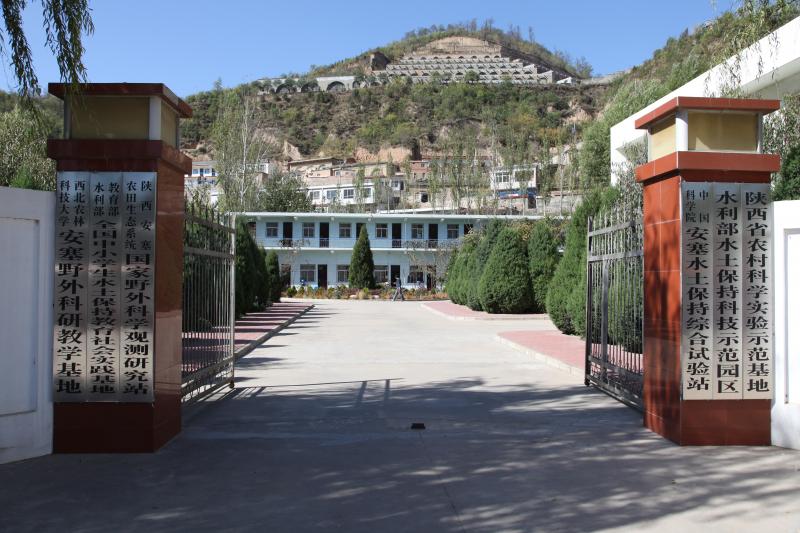
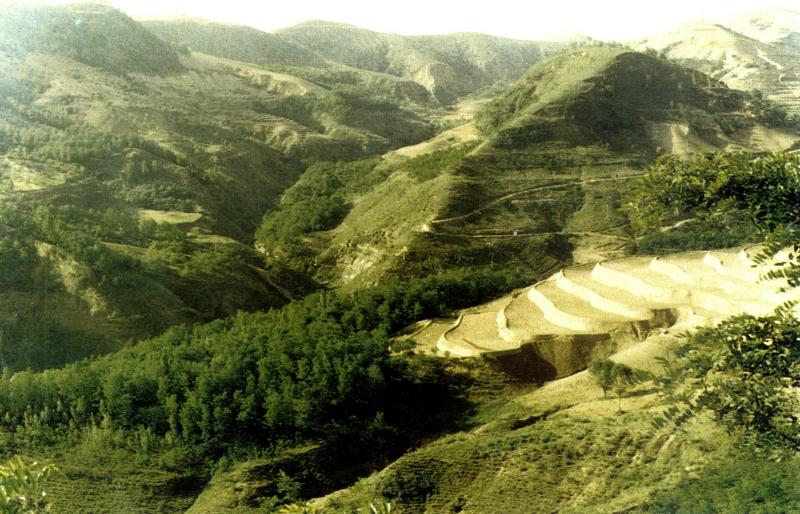
Ansai Integrated Experimental Station on Water and Soil Conservation - China

Basic Information
Platform Icon

Site Name
Ansai Integrated Experimental Station on Water and Soil Conservation
Short name
Ansai Research Station of Soil and Water Conservation
Country
China
Site Manager
Site Description
Ansai Integrated Experimental Station on Water and Soil Conservation is a part of Chinese Ecosystem Research Network, which located in the typical loess hilly and gully region and situates near the center of the Loess Plateau in the Shaanxi Province. The loess-derived soils are fertile but extremely susceptible to erosion. Soil erosion in the study area is much higher than that in the southern part of the Loess Plateau. The climate belongs to transition zone of warm temperate semi-humid to semi-arid, which is dry and windy in spring, hot and rainy in summer, and dry and cold in winter. The mean annual temperature is 8.8 °C. The minimum and maximum temperatures are −23.6 °C in February and 36.8 °C in July. The frost-free period is 157 days. The mean annual precipitation is 505 mm, 70% of which falls between July and September in the form of short heavy storm. The soil is silt loam with the contents of sand, silt, and clay being 24%, 65%, and 11%. Ansai station mainly focus on vegetation rehabilitation, monitoring and assessment of rehabilitation, and monitoring in watershed.
Last modified
2020-06-29 10:06:55

CC-BY-NC Logo

General Characteristics and Status
Site Status
Operational
Year Established
1973
Observed properties
Affiliation and Network Specific Information
Affiliation
ILTERThis site is a verified "ILTER" member.
CERN (LTER China) (LTER-EAP-CN-11)This site is a verified "CERN (LTER China)" member.
GERIThis site is a verified "GERI" member.
Photos
not defined
not defined
not defined
not defined
not defined
not defined
Geographic
Centroid/Representative Coordinates

Latitude: 36.85 Longitude: 109.317

Elevation (min)
1031.00msl
Elevation (max)
1309.00msl
Download

Site information [.json]

Centroid/representative coordinates [.shp] [.kml]
Bounding Box [.shp] [.kml]
Boundaries [.shp] [.kml]