The Pilica River LTER - Poland
DEIMS.ID
https://deims.org/c79080ec-07ec-4c1e-a567-286ba1631405
ProTip! Use the DEIMS.ID to reference sites in papers, reports or anywhere else.
Basic Information
Site Name
The Pilica River LTER
Short name
Pilica River
Country
Poland
Site Manager
Site Description
Last modified
2023-07-26 09:42:57
![]()
General Characteristics and Status
Site Status
Operational
Year Established
1996
Observed properties
Affiliation and Network Specific Information
Affiliation
LTER Poland✖ (LTER_EU_PL_018)The affiliation of this site with "LTER Poland" is not verified by the network on DEIMS-SDR.
Photos
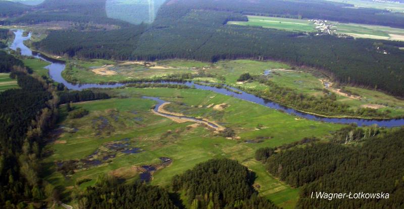
Geographic
Centroid/Representative Coordinates
Latitude: 51.1858 Longitude: 19.541
Size
ca. 1000.00ha
Elevation (average)
105.00msl
Elevation (min)
169.00msl
Elevation (max)
172.00msl
Download