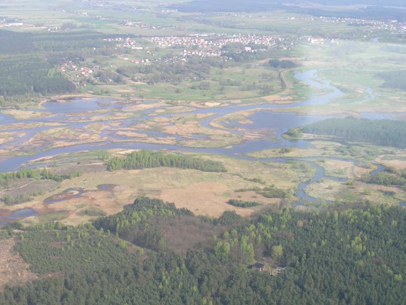
The UNESCO/UNEP the Pilica River Demonstration Site - Poland

Basic Information
Platform Icon

Site Name
The UNESCO/UNEP the Pilica River Demonstration Site
Short name
Pilica LTSER
Country
Poland
Site Manager
Site Description
The UNESCO/UNEP demonstration project of the Pilica River is an LTSER platform comprising four spatial levels: the river and its catchment, the floodplains, and a lowland reservoir. The main activities focus on: implementation of the operational procedures for hydro-biomanipulation at the dam; enhancing the absorbance capacity of floodplain for nutrients and pollutants; identification of hot-spots for the eutrophication of the reservoir in the Pilica catchment; enhancing the potential for nutrient assimilation by small rivers and streams through restoration of plant buffering zones. The site covers the upstream part of the Pilica River catchment (above the Sulejow Reservoir) with marshes, flooded meadows, willow shrubs, arable land, woodlands and small streams. The site was launched in 1996 within the UNESCO-IHP Ecohydrology programme as a demonstration and experimental project that incorporates social factors and refers to management issues of complex catchment-river-reservoir system. Part of the project has been establishing of multi-stakeholder platform and permanent collaboration with local and regional decision makers.
Last modified
2023-07-26 09:07:41

CC-BY-NC Logo

General Characteristics and Status
Site Status
Operational
Year Established
1996
Observed properties
Affiliation and Network Specific Information
Affiliation
ILTERThis site is a verified "ILTER" member.
LTER EuropeThis site is a verified "LTER Europe" member.
LTER Poland (LTER_EU_PL_024)This site is a verified "LTER Poland" member.
Photos
not defined
not defined
not defined
not defined
not defined
not defined
not defined
not defined
not defined
not defined
not defined
not defined
Geographic
Elevation (average)
227.00msl
Elevation (min)
105.00msl
Elevation (max)
350.00msl
Download

Site information [.json]

Centroid/representative coordinates [.shp] [.kml]
Bounding Box [.shp] [.kml]
Boundaries [.shp] [.kml]