Omora Ethnobotanical Park Cape Horn LTER - Chile

Basic Information
Platform Icon

Site Name
Omora Ethnobotanical Park Cape Horn LTER
Short name
Omora
Country
Chile
Site Description
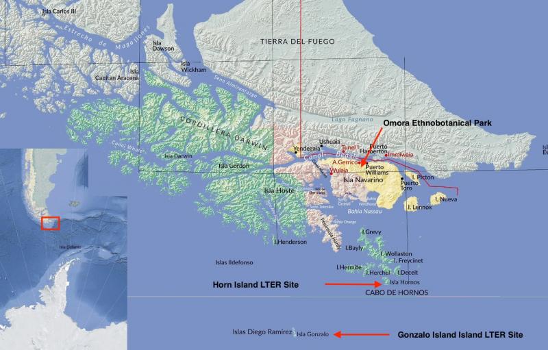
Located in the Cape Horn Biosphere Reserve (UNESCO 2005), the southernmost part of Chile, the Omora Park has a mountain landscape covered by subantarctic forests and wetlands. Omora Park is a botanical garden and protected area, in the north of the Navarino Island, Cape Horn, Region of Magallanes, on the southern shore of the Beagle Channel. This park develops scientific research, education, philosophy, ethics and conservation of the species of the Chilean southern region.
Last modified
2023-07-24 15:07:54

CC-BY-NC Logo

General Characteristics and Status
Site Status
Operational
Year Established
1999
Observed properties
Affiliation and Network Specific Information
Affiliation
ILTERThis site is a verified "ILTER" member.
LTSER Chile (LTER-SAM-CL-3)This site is a verified "LTSER Chile" member.
Photos
not defined
not defined
Cape Horn Biosphere Reserve, Chile
not defined
not defined
not defined
not defined
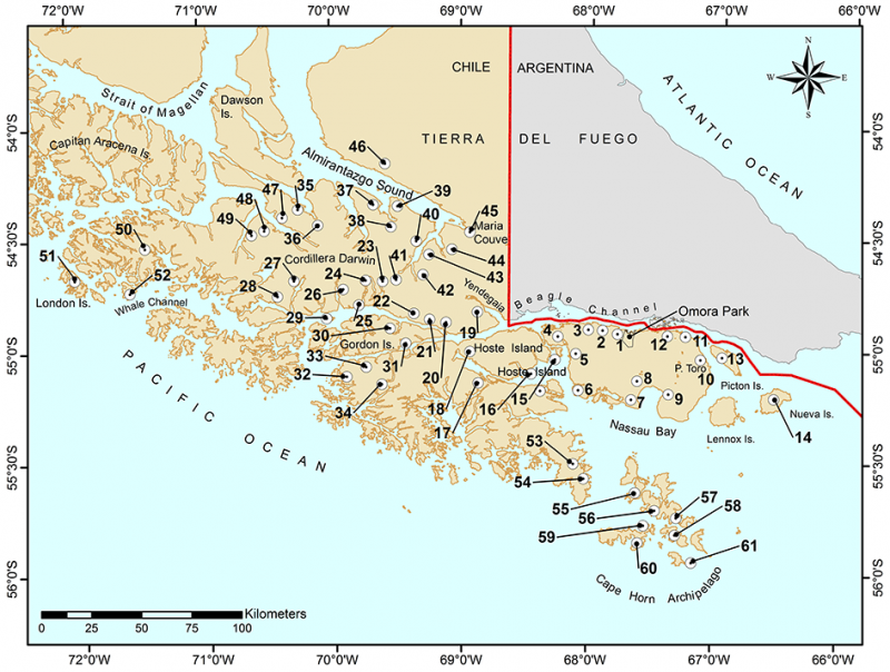
Sampling sites of bird census in the five major regions of the Cape Horn Biosphere Reserve
not defined
not defined
not defined
not defined
not defined
not defined
not defined
not defined
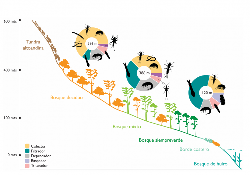
Omora Park altitudinal gradient, Róbalo River watershed
not defined
not defined
not defined
not defined
not defined
not defined
not defined
not defined
Geographic
Centroid/Representative Coordinates

Latitude: -54.9167 Longitude: -67.65

Size
ca. 1018.00ha
Elevation (average)
100.00msl
Elevation (min)
0.00msl
Elevation (max)
1100.00msl
Download

Site information [.json]

Centroid/representative coordinates [.shp] [.kml]