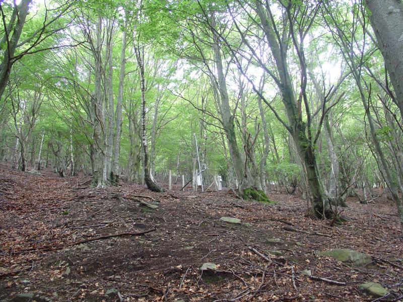
Isone - Switzerland

Basic Information
Site Name
Isone
Short name
ISO
Country
Switzerland
Site Manager
Site Description
The forest site "Isone" has been installed in 1995 as part of the Swiss Long-term Forest Ecosystem Research Programme LWF. The programme investigates anthropogenic and natural forces on the long-term health of the forests and the potential risks to humans. For this, a profound understanding of the relationship between processes, causes and effects in the ecosystem are necessary. The objectives of the LWF research programme include (i) early detection and a representative assessment of changes in forest condition, (ii) determination of external influences, both from anthropogenic and natural sources such as element inputs and climate and their effect on the forest ecosystem, (iii) development of indicators to assess the condition of the forest, (iv) integrated risk assessment based on different stress scenarios, and (v) extended platform for internal and external research projects. The LWF research programme provides, on the one hand, long-term data series from the last 20 years, together with a scientific interpretation to national and international policy makers. On the other hand, the available data and latest LWF infrastructure provide an attractive scientific platform for collaboration with both national and international partners. The site is located next to Isone in the canton of Ticino, within a natural, mixed forest stand which mainly consists of 70-100 year-old beech (Fagus sylvatica) trees. Among others, the site is equipped with two meteorological measurement stations; one is located within the forest stand, the second is co-located in the nearby open-field, allowing to measure the forest stand effect on micro-climate. The following parameters are being measured (starting-end year): Circular vegetation plots (1996-today), Crown Condition Assessment (1996-today), Deadwood survey (1995, 2005-today), Diameter and Height measurements (2000-today), Foliar analyses (1997-today), Leaf area index (LAI) (1996-today), Lichens (2003-today), Litter layer humidity and temperature (1998-today), Manual circumference band measurement (2001-today), Meteorological measurements (1997-today), O3 Injuries (2002-today), Ozone visible injury assessment (2002-today), Passive sampling of O3 (2002), Permanent vegetation quadrats (1996-today), Soil matrix chemistry (1998-today), Soil morphology (1998-today), Tree core sampling (1917-1996), Deadwood sampling (2009-today).
Last modified
2024-03-25 14:03:25

CC-BY-NC Logo

General Characteristics and Status
Site Status
Operational
Year Established
1995
Affiliation and Network Specific Information
Affiliation
Long-term Forest Ecosystem Research (LWF)This site is a verified "Long-term Forest Ecosystem Research (LWF)" member.
ILTERThis site is a verified "ILTER" member.
LTER EuropeThis site is a verified "LTER Europe" member.
ICP Forests (50_6)This site is a verified "ICP Forests" member.
TreeNetThe affiliation of this site with "TreeNet" is not verified by the network on DEIMS-SDR.
LTER Switzerland (LTER_EU_CH_007)This site is a verified "LTER Switzerland" member.
Photos
View over the Isone Vally. Photo: Anne Thimonier Rickenmann, 2021
The meteorological station Isone in the open field. Photo: Peter Waldner, 2012
Meteorological station (stand) at the LWF plot Isone. Photo: Anne Thimonier Rickenmann, 2021
On the instensive monitoring plot of Isone. Photo: Anne Thimonier Rickenmann, 2021
Meteorological station (stand) on the LWF plot Isone. Photo: Anne Thimonier Rickenmann, 2011
Geographic
Centroid/Representative Coordinates

Latitude: 46.1248982 Longitude: 9.0080555

Size
ca. 2.00ha
Elevation (average)
1220.00msl
Elevation (min)
1181.00msl
Elevation (max)
1259.00msl
Download

Site information [.json]

Centroid/representative coordinates [.shp] [.kml]
Bounding Box [.shp] [.kml]
Boundaries [.shp] [.kml]