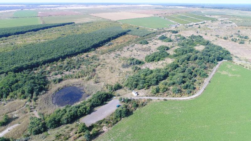
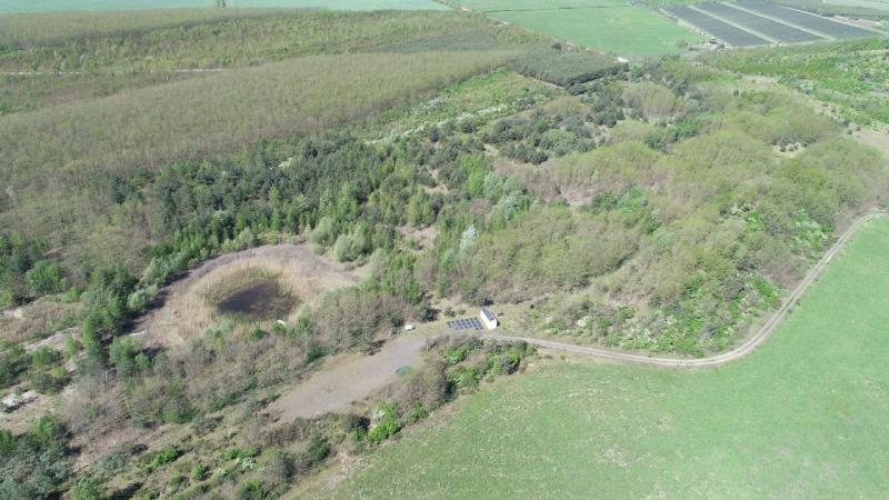
Chicken Creek - Germany

Basic Information
Site Name
Chicken Creek
Short name
Chicken Creek
Country
Germany
Site Description
Since 2005, the " Chicken Creek " research platform has provided opportunities to study ecosystem development from a defined "point zero” as the mining restoration of the area resulted in the application of a sandy substrate without any other biological components. The primary succession has not been influenced by anthropogenic measures, allowing for the observation of natural ecosystem development self-organization. The site enables the development of a local groundwater body and the investigation of feedbacks between hydrological, geomorphological, and botanical structural elements. The initial character of the system is no longer dominant. Despite these changes, the comprehensive monitoring data offer diverse opportunities for further research. In addition to continuing the data series, moderate use of invasive methods is now possible, allowing for deeper analyses and new connections to previously collected data. Future research will focus on transformative landscape development and climate change. The research topics here concentrate on nutrient and carbon cycles of ecosystems and in particular on the tree species robinia, as well as on soil stability and hydrology.
Last modified
2025-05-30 14:05:10

CC-BY-NC Logo

General Characteristics and Status
Site Status
Operational
Year Established
2005
Observed properties
Affiliation and Network Specific Information
Affiliation
LTER-D (Germany)The affiliation of this site with "LTER-D (Germany)" is not verified by the network on DEIMS-SDR.
Photos
Chicken Creek catchment in 2017 (source: BTU Cottbus-Senftenberg, FZLB)
Chicken Creek catchment in 2024 (source: BTU Cottbus-Senftenberg, FZLB)
Geographic
Centroid/Representative Coordinates

Latitude: 51.604392 Longitude: 14.267069

Size
ca. 6.69ha
Elevation (average)
132.00msl
Elevation (min)
124.00msl
Elevation (max)
140.00msl
Download

Site information [.json]

Centroid/representative coordinates [.shp] [.kml] [.geojson]
Bounding Box [.shp] [.kml] [.geojson]