Glensaugh - United Kingdom

Basic Information
Site Name
Glensaugh
Short name
T02
Country
United Kingdom
Operating Organisation
Site Manager
Site Description
UK ECN site. Glensaugh is one of two terrestrial ECN sites currently managed by the James Hutton Institute. Glensaugh Research station is 35 miles south west of Aberdeen, NE Scotland (NGR NO 671783), on the edge of the Grampian hills and covers over 1100 hectares. The dominant cover is semi-natural vegetation, and there is a small amount of woodland (5ha) and some short term and permanent grassland (150ha). Much of the ECN monitoring is carried out towards the northern boundary of the research station in the small upland catchment of the Birnie Burn. Winters can be severe and snow may lie in patches until late March. The target sampling site is located at an altitude of 300m on heather dominated (Calluna vulgaris) moorland ...
Show more ...
Last modified
2023-07-28 10:07:12

CC-BY-NC Logo

General Characteristics and Status
Site Status
Operational
Year Established
1992
Observed properties
soil parameteratmospheric parameterecosystem parameterchemical parameterwater parameterbiological parameterlandscape parameteragricultural parametercarbon-to-nitrogenratiocationexchangecapacitydissolvedorganicnitrogeninsoilsoilaciditysoilbulkdensitysoilmoisturefieldcapacitysoilsolutionconcentrationsoiltemperaturethicknessofsoilhorizontotalorganiccarbonairhumiditynetradiationirradiancenetsolarradiationirradianceprecipitationintensitysnowdepthsolarradiationtotalradiationirradiancewinddirectionwindspeedbirdspresencebryophytespresencediversityindexfloristicdiversityplantspeciescompositionspeciescompositionspeciespresencespeciesturnovertreediameteratbreastheightavailablephosphorusdissolvedorganicphosphorusinorganiccarboncontentpercentcarbonpercentorganiccarbonsoilpHtotalcarbontotalorganiccarbonconductivityrunoffamountstageheightwateraciditywaterlevelwaterqualitywatertablewatervolumetreediametertreeheightlandcoverlandusedissolvedorganiccarboninsoil
Affiliation and Network Specific Information
Affiliation
ILTERThis site is a verified "ILTER" member.
LTER EuropeThis site is a verified "LTER Europe" member.
UK Eutrophying and Acidifying atmospheric Pollutants network (UKEAP)The affiliation of this site with "UK Eutrophying and Acidifying atmospheric Pollutants network (UKEAP)" is not verified by the network on DEIMS-SDR.
UK ECN (LTER_EU_UK_048)This site is a verified "UK ECN" member.
COSMOS-UKThe affiliation of this site with "COSMOS-UK" is not verified by the network on DEIMS-SDR.
Photos
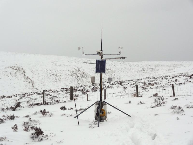
Automatic Weather Station at ECN Glensaugh
Geographic
2 km
1 mi
Centroid/Representative Coordinates

Latitude: 56.9 Longitude: -2.55

Size
ca. 1125.00ha
Elevation (average)
241.00msl
Elevation (min)
137.00msl
Elevation (max)
487.00msl
Download

Site information [.json]

Centroid/representative coordinates [.shp] [.kml]
Bounding Box [.shp] [.kml]
Boundaries [.shp] [.kml]