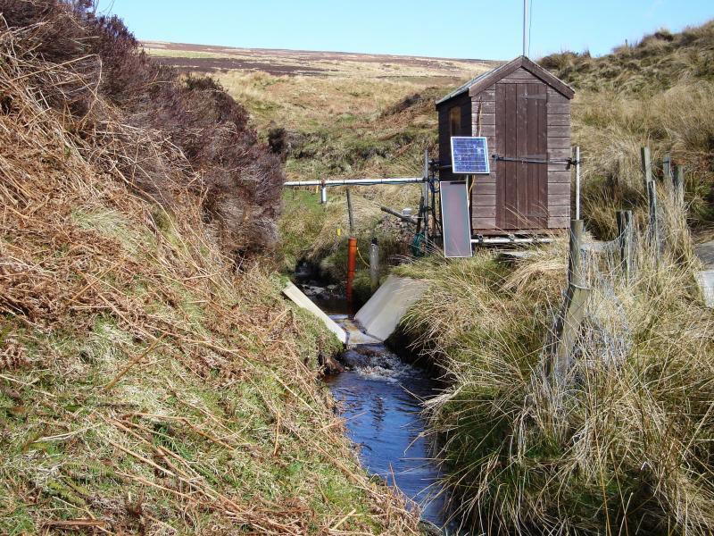
Birnie Burn - United Kingdom

Basic Information
Site Name
Birnie Burn
Short name
R27
Country
United Kingdom
Operating Organisation
Site Manager
Site Description
UK ECN site. This ECN freshwater sampling site is a small stream co-located with the James Hutton Institute's terrestrial site at Glensaugh. Glensaugh Research station is located 35 miles south west of Aberdeen, NE Scotland. (NGR NO 671783) on the edge of the Grampian hills and covers over 1100 hectares. There is a small amount of woodland (5ha) and some short term and permanent grassland (150ha) but the dominant cover is semi-natural vegetation which accounts for the remaining area. The Birnie Burn drains a small upland catchment of 0.8 km2 located toward the northern boundary of the research station. The highest hills in the catchment are to the North where they reach an altitude of around 450m. The ECN sampling point and gauging station are located less than 1km south of the stream source at an altitude of 240m a.s.l. The soils and the vegetation within the catchment area can be broadly classified into three zones. The upper zone (>400m a.s.l.) is characterised by hill peats developed on gentle slopes and covered by peat mosses (Sphagnum sp) and cotton grass (Eriophurum vaginatum). The middle zone (350-400m a.s.l.) features freely drained podzols that have developed in thin glacial till on the steeper slopes. The dominant vegetation types in this zone are heather (Calluna vulgaris), blaeberry (Vaccinium myrtillus) and wavy hair grass (Deschampsia flexuosa). The lower zone (220-350m a.s.l.) has freely draining iron podzols developed on thin glacial tills on steep heather and blaeberry covered slopes. The hydrology of the Birnie Burn is typical of upland headwaters in general, in that a combination of steep slopes and thin soils allows precipitation to be delivered rapidly to the stream, resulting in quite a flashy run-off regime. The stream channel is narrow (generally less than 1m) during base-flow conditions and depths vary from 10-20cm along some shallow riffled sections reaches to deeper pools of up to 80cm. Note: this site is a single point sampling location on a river. The shape file indicates the Glensaugh site.
Last modified
2023-07-28 09:07:48

CC-BY-NC Logo

General Characteristics and Status
Site Status
Operational
Year Established
2004
Observed properties
Affiliation and Network Specific Information
Affiliation
ILTERThis site is a verified "ILTER" member.
LTER EuropeThis site is a verified "LTER Europe" member.
UK ECN (LTER_EU_UK_044)This site is a verified "UK ECN" member.
Projects
Photos
Stream monitoring point on Birnie Burn
Geographic
Centroid/Representative Coordinates

Latitude: 56.9 Longitude: -2.55

Elevation (average)
241.00msl
Elevation (min)
137.00msl
Elevation (max)
487.00msl
Download

Site information [.json]

Centroid/representative coordinates [.shp] [.kml]
Bounding Box [.shp] [.kml]
Boundaries [.shp] [.kml]