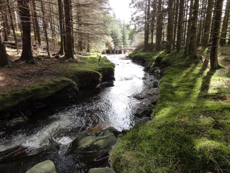
Afon Hafren - United Kingdom

Basic Information
Site Name
Afon Hafren
Short name
UWMN_17
Country
United Kingdom
Site Manager
Site Description
UK Upland Waters Monitoring Network (UK UWMN) site. The Afon Hafren lies in the Cambrian Mountains of mid-Wales and from its confluence with the Afon Hore forms the headwaters of the River Severn. The catchment area is 358 ha and rises from 355 m at the sampling station to 690 m at Blaenhafren. Stagnoodsols cover approximately 40% of the catchment and organic peaty soils comprise the remaining area. The underlying geology consists of Ordovician grits and Silurian mudstones and shales. Fifty percent of the catchment is planted with conifers, primarily Sitka and Norway spruce, and forms part of the larger Hafren Forest; planting took place primarily between 1948-1950 and 1963-1964. At the start of monitoring about 5% of the catchment consisted of recently felled forest. Since that time there has been steady harvesting and replanting of large areas continuing right up to the present day though this appears to have had little impact on stream water chemistry. Moorland grasses and Calluna occupy the remainder of the catchment and are utilised for rough grazing. Prior to afforestation the catchment was exploited as upland sheepwalk. Rainfall is c. 2500 mm annually. Some data are managed by UK ECN Data Centre. Note: The area is the size of the catchment. Note that Afon Hafren is within the Plynlimon Experimental Catchments (see http://data.lter-europe.net/deims/site/EXPEER-UK-02).
Last modified
2023-07-28 11:07:03

CC-BY-NC Logo

General Characteristics and Status
Site Status
Operational
Year Established
1988
Observed properties
Affiliation and Network Specific Information
Affiliation
UK Upland Waters Monitoring Network (UWMN_17)The affiliation of this site with "UK Upland Waters Monitoring Network" is not verified by the network on DEIMS-SDR.
Photos
Plynlimon, Hafren
Plynlimon, Hafren
Geographic
Elevation (average)
522.00msl
Elevation (min)
355.00msl
Elevation (max)
690.00msl
Download

Site information [.json]

Centroid/representative coordinates [.shp] [.kml]
Bounding Box [.shp] [.kml]
Boundaries [.shp] [.kml]