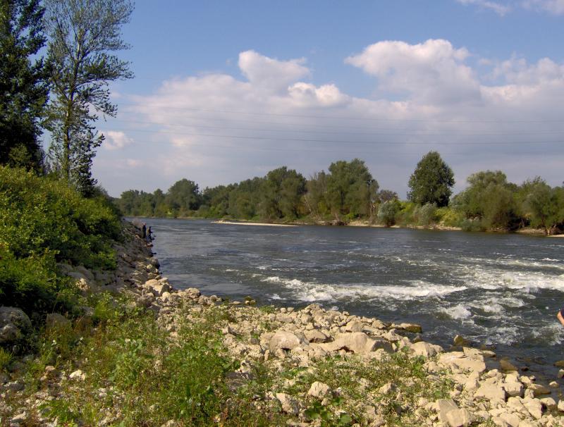
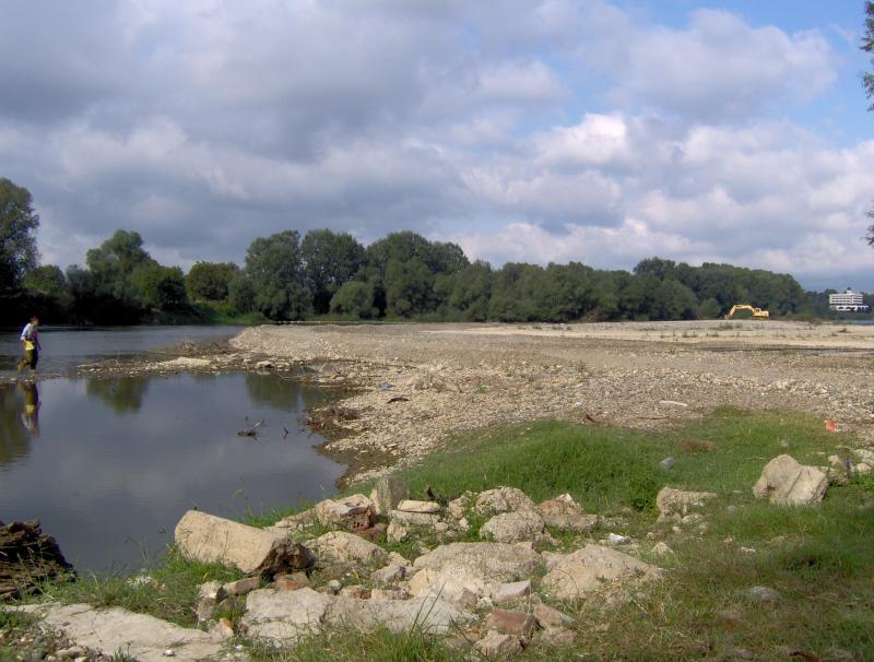
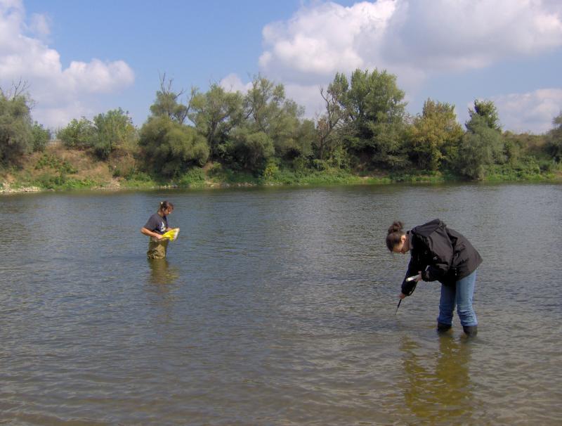
Velika Morava - Serbia

Basic Information
Site Name
Velika Morava
Short name
V_Morava
Country
Serbia
Operating Organisation
Site Manager
Funding Agency
Site Description
Velika Morava is 175 km long river originating from Western and Southern Morava Rivers. The whole catchment area (including Western and Southern Morava) is about 38.000 km², while the basin area of Velika Morava is 6.760 km². The mean annual flow is 245 m³ s-1 (gauge station Ljubicevo, near to the mouth of the Danube - Annual Water Quality Reports 1999-2008). Based on the size of catchments area and its flow, Velika Morava is one of the major tributaries of the Danube. Over 95% of the basin is located at the territory of the Republic Serbia. The water regime is unimodal, characterized by the prominent seasonal fluctuations. In the spring the river can be almost torrential (the mean flow near to the mouth 560 m³/s), while in the rest of the year there is a "low water" period, particularly in the autumn, when mean flow does not exceed 100 m³/s. The riverbed is 80-200 m wide, and up to 10 m deep, although average depth usually does not exceed 2 m. The silicates are the dominant geological substrate in entire catchment area. According to the main geographical features the river could be divided into two main parts. The lower one, from confluence with Dunav to the Resava River mouth (near Svilajnac), is 85 km long typical lowland watercourse (altitude lower the 100 m), with 0.35 ‰ declination, and with sand and mud/silt as dominant fractions of the riverbed. This part of the Velika Morava River belongs to Ecoregion 11 (ER11_Ser). The upper one, from the Resava river mouth to Stalac (the confluence of Southern and Western Morava Rivers), is 90 km long. The mean altitude is over 100 m a.s.l. (to 135 m), declination is 0.44 ‰ and in the riverbed the dominant part are sand and gravel fractions. Upper part belongs to Ecoregion 5 (ER5_Ser). Velika Morava river basin has four permanent monitoring sites. The area is densely populated and the river is under the influence of various pollution sources (organic, agricultural, industrial), as well as hydromorphological pressures (meander cutting, shortening, channeling, as well as gravel and send extraction).
Last modified
2021-11-23 11:11:18

CC-BY-NC Logo

General Characteristics and Status
Site Status
Operational
Year Established
2010
Observed properties
Affiliation and Network Specific Information
Affiliation
ILTERThis site is a verified "ILTER" member.
LTER EuropeThis site is a verified "LTER Europe" member.
LTER Serbia (LTER_EU_RS_011)This site is a verified "LTER Serbia" member.
Photos
not defined
not defined
not defined
not defined
not defined
not defined
Geographic
Centroid/Representative Coordinates

Latitude: 43.7547 Longitude: 21.3936

Elevation (average)
102.90msl
Elevation (min)
66.60msl
Elevation (max)
129.40msl
Download

Site information [.json]

Centroid/representative coordinates [.shp] [.kml]
Bounding Box [.shp] [.kml]
Boundaries [.shp] [.kml]