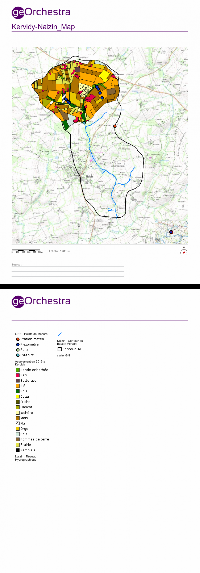
OZCAR-RI AgrHyS Environmental Research Observatory Site of Kervidy-Naizin - France
DEIMS.ID
https://deims.org/9602b733-7bb8-4f51-9857-2c73c53edee3
ProTip! Use the DEIMS.ID to reference sites in papers, reports or anywhere else.
Basic Information
Site Name
OZCAR-RI AgrHyS Environmental Research Observatory Site of Kervidy-Naizin
Short name
ERO AgrHyS Kervidy-Naizin Site
Country
France
Web Address
Operating Organisation
Site Manager
Site Description
Last modified
2024-04-09 22:30:39
![]()
General Characteristics and Status
Site Status
Operational
Year Established
1992
Observed properties
Affiliation and Network Specific Information
Affiliation
ILTER✔This site is a verified "ILTER" member.
OZCAR RI✔This site is a verified "OZCAR RI" member.
LTER Europe✔This site is a verified "LTER Europe" member.
LTER France✔ (CZO_EU_FR_012)This site is a verified "LTER France" member.
Critical Zone Collaborative Network (CZ Net)✖The affiliation of this site with "Critical Zone Collaborative Network (CZ Net)" is not verified by the network on DEIMS-SDR.
Photos

Geographic
Centroid/Representative Coordinates
Latitude: 48.006143 Longitude: -2.830841
Size
ca. 500.00ha
Elevation (average)
114.00msl
Elevation (min)
93.00msl
Elevation (max)
135.00msl
Download