Rhine-Main-Observatory - Germany
Basic Information
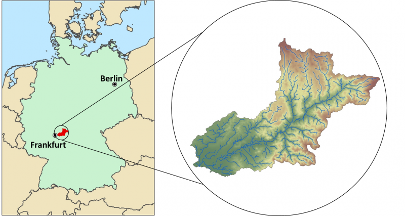
Site Name
Rhine-Main-Observatory
Short name
DE-12-RMO
Country
Germany
Operating Organisation
Site Manager
Site Description
Last modified
2025-12-11 11:12:01
![]()
General Characteristics and Status
Site Status
Operational
Year Established
2007
Observed properties
eLTER Standard Observations
Affiliation and Network Specific Information
Affiliation
ILTER✔This site is a verified "ILTER" member.
LTER Europe✔This site is a verified "LTER Europe" member.
GERI✔This site is a verified "GERI" member.
LTER-D (Germany)✔ (LTER_EU_DE_012)This site is a verified "LTER-D (Germany)" member.
Photos


Geographic
Centroid/Representative Coordinates
Latitude: 50.267302 Longitude: 9.269139
Size
ca. 10580.00ha
Elevation (average)
110.00msl
Elevation (min)
100.00msl
Elevation (max)
200.00msl
Download