Allt a'Mharcaidh - United Kingdom

Basic Information
Site Name
Allt a'Mharcaidh
Short name
R14
Country
United Kingdom
Site Description
UK ECN site. Allt a'Mharcaidh is a stream site on the western flank of the Cairngorm Mountains. The catchment area is 998ha and it drains to the River Feshie, a tributary of the River Spey. The catchment rises from 325m at the sampling site to 1111m and is covered by alpine and peaty podsols (60%) and blanket peat (40%). The underlying geology is intrusive biotite-granite of the Lower Old Red Sandstone age. Vegetation is characterised by a heather/fescue grass mixture (90%) with native pinewoods (c. 2%) interspersed along the lowest reaches. The catchment comprises part of the Cairngorm National Nature Reserve and land-use is confined to deer grazing. The stream gradient is steep and exposed bedrock, rapids and waterfalls and large boulders characterise the monitored channel section. Note: this site is a single point sampling location (gauging station) on a river. The shape file indicates the whole river catchment.The stream site is nested within the Cairngorms National Park LTSER site (http://data.lter-europe.net/deims/site/LTER_EU_UK_059), which also contains the Cairngorms terrestrial ECN site.
Last modified
2023-07-28 11:07:45

CC-BY-NC Logo

General Characteristics and Status
Site Status
Operational
Year Established
1992
Observed properties
Affiliation and Network Specific Information
Affiliation
ILTERThis site is a verified "ILTER" member.
UK Upland Waters Monitoring Network (UWMN_02)The affiliation of this site with "UK Upland Waters Monitoring Network" is not verified by the network on DEIMS-SDR.
LTER EuropeThis site is a verified "LTER Europe" member.
UK ECN (LTER_EU_UK_031)This site is a verified "UK ECN" member.
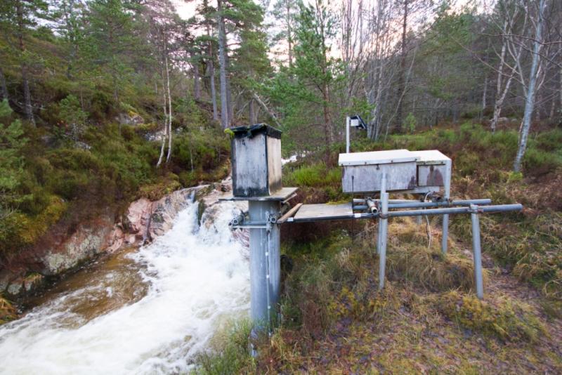
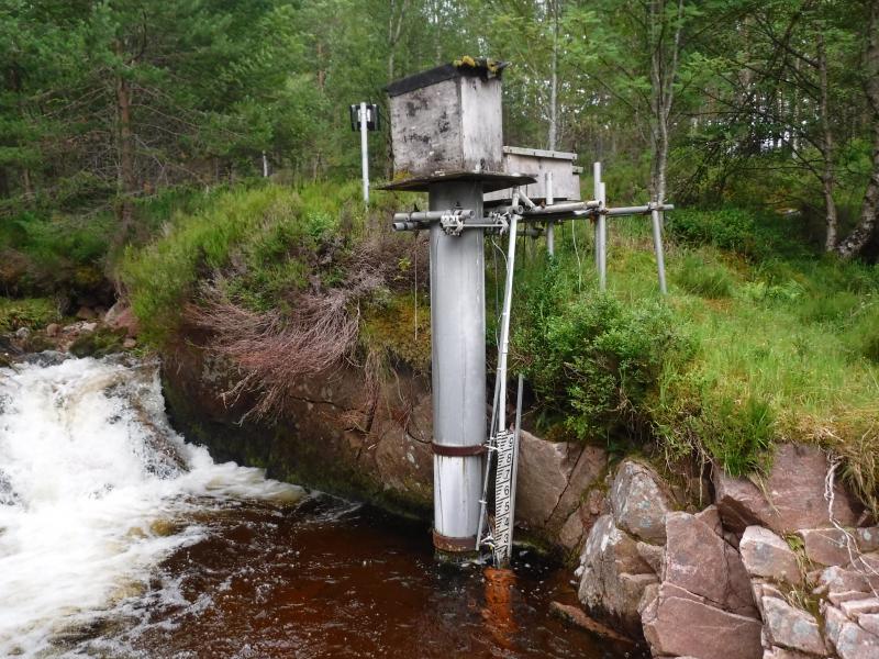
Photos
Allt a'Mharcaidh stream
Gauging station
Gauging station
Gauging station
Gauging station
Allt a'Mharcaidh stream
Geographic
Elevation (average)
718.00msl
Elevation (min)
325.00msl
Elevation (max)
1111.00msl
Download

Site information [.json]

Centroid/representative coordinates [.shp] [.kml]
Bounding Box [.shp] [.kml]
Boundaries [.shp] [.kml]