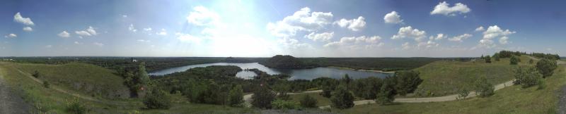
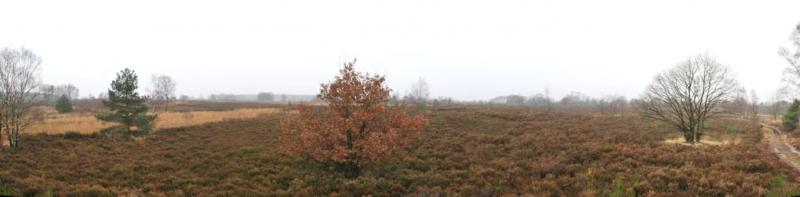
National Park Hoge Kempen - Belgium
DEIMS.ID
https://deims.org/dae8cf66-bdca-47db-b595-7bf6c1762e00
ProTip! Use the DEIMS.ID to reference sites in papers, reports or anywhere else.
Basic Information
Site Name
National Park Hoge Kempen
Short name
LTSER NPHK
Country
Belgium
Web Address
Site Manager
Site Description
Last modified
2024-09-12 17:16:49
![]()
General Characteristics and Status
Site Status
Operational
Year Established
2006
Observed properties
Affiliation and Network Specific Information
Affiliation
Organization of Biological Field Stations (OBFS)✖The affiliation of this site with "Organization of Biological Field Stations (OBFS)" is not verified by the network on DEIMS-SDR.
ILTER✔This site is a verified "ILTER" member.
LTER Europe✔This site is a verified "LTER Europe" member.
LTER Belgium✔ (LTER_EU_BE_11)This site is a verified "LTER Belgium" member.
GERI✔This site is a verified "GERI" member.
AnaEE✖The affiliation of this site with "AnaEE" is not verified by the network on DEIMS-SDR.
Lifewatch✖The affiliation of this site with "Lifewatch" is not verified by the network on DEIMS-SDR.
Photos
Geographic
Centroid/Representative Coordinates
Latitude: 50.964926 Longitude: 5.626886
Size
ca. 5746.00ha
Elevation (average)
78.00msl
Elevation (min)
40.00msl
Elevation (max)
104.00msl
Download