Röbäcksdalen Field Research Station - Sweden

Basic Information
Site Name
Röbäcksdalen Field Research Station
Short name
Röbäcksdalen
Country
Sweden
Operating Organisation
Site Description
Röbäcksdalen research station was established 1954 and contains a field station and a dairy barn. The field station offers the ability to perform field research in a variety of areas such as agricultural science, biology, agroecology, soil science and environmental science. At the infrastructure it is possible to do research in a variety of areas such as animal science, agricultural science, ecology, phenology, climatology, geochemistry, biology, agroecology, soil science and environmental science. Visitors and users of the infrastructure can get access to the land and a stream collecting drainage and surface runoff-water from the area, animals in the dairy facility, workshop, machines, measuring equipment and techniques, personnel, laboratories and working stations. All data that is gathered within the infrastructure can also be available for the user, most of with is continuously collected data, data from feeding trials, climate data, soil data, data from water samples of runoff-water, data from the catchment area around the station as well as GIS data and data from different long-term-trials. The predominant soil type at the experimental fields is sandy-silt, which is characterized by good water holding capacity and high capillarity, hence the crops seldom suffer from drought here. The humus content is high (3-6%) which means that the soil is not so dense, something that otherwise might be a problem for this soil type. Sandy soil is present in limited areas. We are active in four different locations in northern Sweden. At Röbäcksdalen we manage the station and on the other sites we collaborate with Lantmännen Lantbruk at Lännäs (Västernorrland), Torsta AB at Ås (Jämtland) and Hushållningssällskapet Norrbotten och Västerbotten at Öjebyn (Norrbotten). The dairy barn was built in 2006 and has around 105 dairy cows of the breed Swedish red. The barn can e.g. be used for feed trials and among the equipment are two Greenfeed units that measure greenhouse gases (GHG) produced by the animals. The inclusion of the barn also offers farm scale studies of e.g. production of GHG or N or P flows.
Last modified
2025-01-07 11:01:56

CC-BY-NC Logo

General Characteristics and Status
Site Status
Operational
Year Established
1954
Observed properties
Climate
Precipitation Sum:    526 mm
Temperature Mean: 4.54 °C
Standard Reference Period: Other, non-standardised or incomplete reference period
Affiliation and Network Specific Information
Affiliation
ILTERThis site is a verified "ILTER" member.
Swedish Infrastructure for Ecosystem Science (SITES)This site is a verified "Swedish Infrastructure for Ecosystem Science (SITES)" member.
LTER EuropeThis site is a verified "LTER Europe" member.
LTER Sweden (LTER_EU_SE_022)This site is a verified "LTER Sweden" member.
GERIThis site is a verified "GERI" member.
Photos
Harvesting oats. Photographer: Malin Barrlund
Research plot from a previous biodiversity experiment (Biodepth). Photographer: Cecilia Palmborg
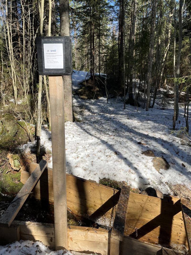
Water sampling point upstream of the agricultural fields. Photographer: Matilda Andersson
Water sampling location for stream running through agricultural fields. Photographer: Matilda Andersson
The weather station in the field.  Photographer: Johanna Wallsten
The weather station in the field. Photographer: Johanna Wallsten
Geographic
Centroid/Representative Coordinates

Latitude: 63.8106 Longitude: 20.2417

Size
ca. 270.00ha
Elevation (average)
12.00msl
Elevation (min)
10.00msl
Elevation (max)
13.00msl
Download

Site information [.json]

Centroid/representative coordinates [.shp] [.kml]
Bounding Box [.shp] [.kml]
Boundaries [.shp] [.kml]