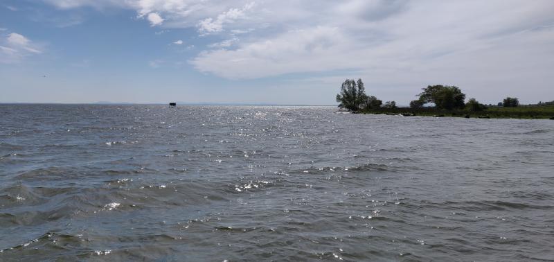
Lough Neagh - United Kingdom

Basic Information
Site Name
Lough Neagh
Short name
L16
Country
United Kingdom
Site Description
UK ECN site. Lough Neagh covers 383 km2 and is by far the largest area of freshwater in the British Isles. Situated in the north-east of the island, it has a drainage basin of 4,453 km2, which is shared between Northern Ireland (91%) and the Republic of Ireland (9%). The average water retention time is 15 months. Although large in area, the lake is relatively shallow with a mean depth of 8.9 m (max. 25 m). This, combined with its great size and a mild and windy oceanic climate, ensures that the water column is generally well mixed. The lake supports commercial fisheries for European eel, pollan, perch and trout. The eel fishery is the most significant, with an annual catch in the region of 600 t. Lough Neagh is hypertrophic ...
Show more ...
Last modified
2023-07-28 10:07:33

CC-BY-NC Logo

General Characteristics and Status
Site Status
Operational
Year Established
1992
Observed properties
water parameterchemical parameterecosystem parameterbiological parameterconductivitylakelevellaketemperaturewateraciditywateralkalinitywaterlevelwaterqualitywatertemperaturewatertransparencyammoniumcontentdissolvedorganiccarboninwatersuspendedsolidstotalorganiccarbonbenthicinvertebratesabundancebenthicinvertebratespresencespeciesabundancespeciespresencenitrogencontent
Affiliation and Network Specific Information
Affiliation
ILTERThis site is a verified "ILTER" member.
LTER EuropeThis site is a verified "LTER Europe" member.
UK ECN (LTER_EU_UK_016)This site is a verified "UK ECN" member.
Projects
Photos
View of Lough Neagh
View of Lough Neagh
Geographic
30 km
20 mi
Centroid/Representative Coordinates

Latitude: 54.55 Longitude: -6.38333

Size
ca. 38600.00ha
Elevation (average)
10.00msl
Elevation (min)
10.00msl
Elevation (max)
10.00msl
Download

Site information [.json]

Centroid/representative coordinates [.shp] [.kml]
Bounding Box [.shp] [.kml]
Boundaries [.shp] [.kml]