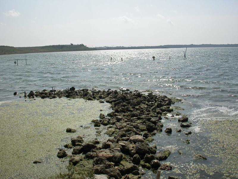
The Mar Piccolo is an inner, semi-enclosed sea located on the North of the town of Taranto showing lagoon features. It has a surface area of 20.72 Km2 and is divided by two promontories of land into two smaller inlets, called the First and the Second Inlet, which have a maximum depth of 12 and 8 m, respectively. Two canals, Navigable Canal (width 58 m, depth 12 m) and Porta Napoli Channel (width 48 m, depth 2.5 m), the most important for the water exchange, put the Mar Piccolo in communication with the nearby Mar Grande basin. The scarce hydrodinamism and the reduced water exchange, mainly in the Second Inlet, with the nearby Mar Grande determine the stratification of the water, especially in summer.
Due to the strong anthropogenic impact, most of hard substrata are artificial. Soft substrata are sandy near the shore and muddy in the central zone of both Inlets.
In the Mar Piccolo basin, tidal range is reduced, not exceeding 30-40 cm. Chemical-physical features of the basin, deeply studied in the last years, show a variable trend according to the seasons and to the Inlets. The two basins are characterized by different levels of confinement. Such a confinement is evident for chemichal-physical variables and let to immediately single out the two basins, as the variables values change moving from the First Inlet to the Second Inlet. Always along the same direction, besides the confinement, an evident increase of all the variables fluctuations is observable which points out a noticeable instability of the most confined basin.
The lagoon features of the Mar Piccolo are mainly due to the presence of 34 submarine freshwater springs (locally called "Citri") of which 20 are in the First Inlet and 14 in the Second Inlet . The most important are “Galeso” (mean flow 600 L s-1) and “Citrello” (mean flow 350 L s-1) in the First Inlet and “Le Copre” (mean flow 80 L s-1) in the Second Inlet. The freshwater of the “Citri” has a uniform temperature of 18°C; therefore, they locally affect both the salinity and the temperature of seawater.
Moreover, in the Mar Piccolo several small tributary rivers flow, of which the most important is “Galeso” (mean flow 50,000 m3day-1) in the First Inlet; other small rivers, less important because their flow is strongly affected by the seasons, are “Cervaro”, “Rasca” and “Rubafemmine” in the Second Inlet. Salinity ranges from 34.3 to 37.7. Seawater temperature ranges from 7.1°C to 33.6°C.
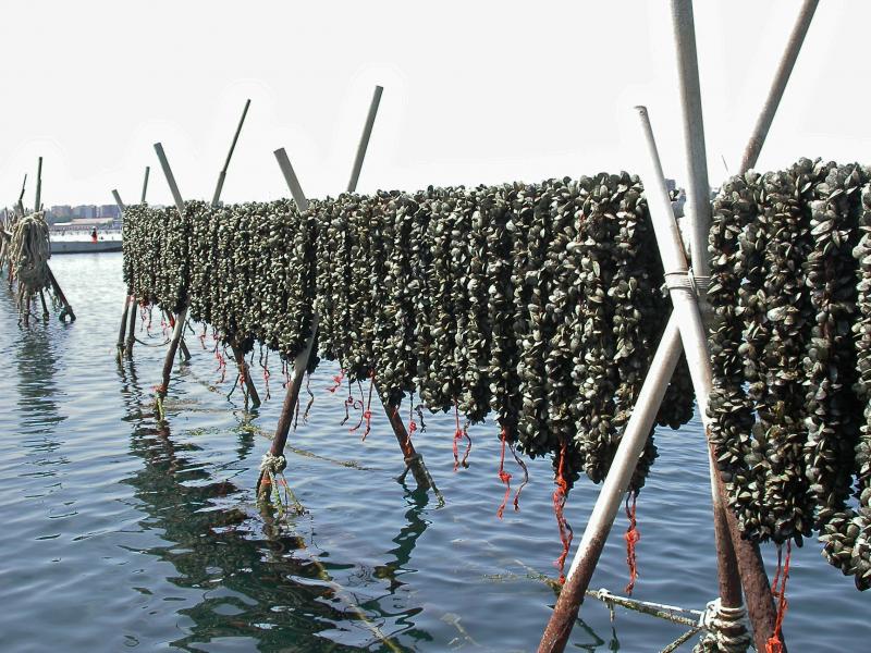
Since the Mar Piccolo is an enclosed and therefore sheltered basin, it has been using for human activities for a long time. Indeed, it houses the biggest mussel farm in Italy with plants widely distributed in both the Inlets, which has a production of about 30,000 tons year-1 and employs about 800 people. Until few years ago, the most important Italian Navy base was located in the First Inlet of which only the dry-docks are still present. In addition, a small fishing fleet, of about 300 boats, is present in the First Inlet. The water-scooping machine of the steel industry catches seawater from the basin for the cooling plants. Moreover, the Mar Piccolo is subject to agricultural pollution because the irrigating waters of the surrounding fields flow into the basin by both the rivers and the submarine freshwater springs.
Up to 2000, also 14 urban sewage outfalls flowed into the basin coming from some small cities near Taranto. Starting from this year, the outfalls of 11 of these were closed since their seawage pipes were connected to Bellavista depuration plant flowing outside the Mar Grande basin; currently, only 5 seawage outfalls (1 in the First Inlet and 4 in the Second Inlet) till flow into the basin. Therefore, the discharging of waste waters in the basin has noticeably been reduced.


