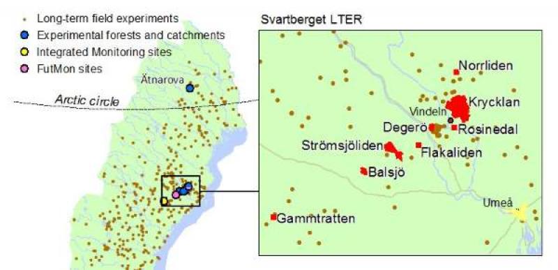
Svartberget Research Station - Sweden
DEIMS.ID
https://deims.org/c0705d0f-92c1-4964-a345-38c0be3113e1
ProTip! Use the DEIMS.ID to reference sites in papers, reports or anywhere else.
Basic Information
Site Name
Svartberget Research Station
Short name
Svartberget
Country
Sweden
Web Address
Site Manager
Site Description
Last modified
2024-09-12 17:32:01
![]()
General Characteristics and Status
Site Status
Operational
Year Established
1923
Observed properties
Affiliation and Network Specific Information
Affiliation
ILTER✔This site is a verified "ILTER" member.
Swedish Infrastructure for Ecosystem Science (SITES)✔This site is a verified "Swedish Infrastructure for Ecosystem Science (SITES)" member.
LTER Europe✔This site is a verified "LTER Europe" member.
ICOS✔ (http://meta.icos-cp.eu/resources/stations/AS_SVB) (https://meta.icos-cp.eu/resources/stations/ES_SE-Svb)This site is a verified "ICOS" member.
LTER Sweden✔ (LTER_EU_SE_006)This site is a verified "LTER Sweden" member.
GERI✔This site is a verified "GERI" member.
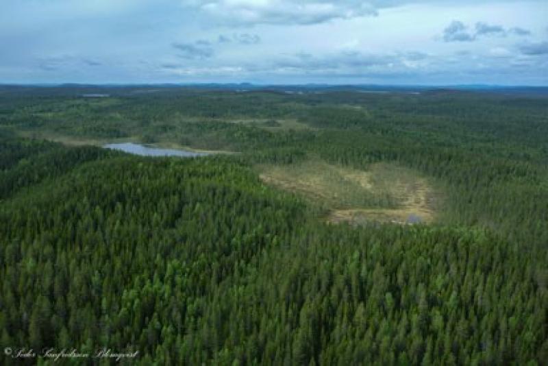
Photos


Geographic
Centroid/Representative Coordinates
Latitude: 64.244376 Longitude: 19.766378
Size
ca. 2531.00ha
Elevation (average)
275.00msl
Elevation (min)
170.00msl
Elevation (max)
300.00msl
Download