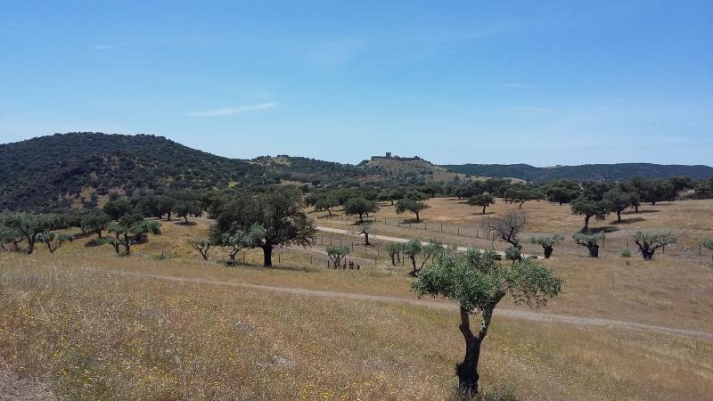
Herdade da Coitadinha - Portugal

Basic Information
Site Name
Herdade da Coitadinha
Short name
Montado 05_HCoi
Country
Portugal
Site Manager
Site Description
Herdade da Coitadinha is one of the six research and monitoring stations of LTER-Montado, an umbrella site located in the Alentejo province in south Portugal (southwestern Iberia). The "Montado" represents an unique agro-silvo-pastoral ecosystem (named "dehesa" in Spain) found only in the Mediterranean basin. These savannah-like landscapes are dominated by evergreen cork and/or holm oaks and were shaped over millennia of traditional land use practices. These multi-use forests are two-layered systems that combine, in a single space, forest harvesting, extensive livestock husbandry, pastures and/or cereal cultivation (the most evident economical revenues), with other traditional uses (hunting, beekeeping and mushroom picking). ...
Show more ...
Last modified
2023-07-25 08:07:43

CC-BY-NC Logo

General Characteristics and Status
Site Status
Operational
Year Established
2011
Observed properties
ecosystem parameterlandscape parameteratmospheric parameterbiological parameterbirdspresencediversityindexecosystemstructurefaunisticdiversityfloristicdiversityforeststructurenormalizedvegetationindexplantspeciescompositionspeciescompositionspecieslistspeciespresencespeciesturnovertreediameteratbreastheightvegetationlayercompositionvegetationlayerstructurevegetationlayertypelandcoverlanduselanduseintensitylandscapecompositionlandscapeconfigurationlandscapefragmentationlandscapemetricspatchdensitypatchsizeairhumidityairtemperatureprecipitationintensitysolarradiationwindspeedcanopycoverrate
Affiliation and Network Specific Information
Affiliation
ILTERThis site is a verified "ILTER" member.
LTER EuropeThis site is a verified "LTER Europe" member.
LTER Portugal (LTER_EU_PT_007)This site is a verified "LTER Portugal" member.
Photos
not defined
not defined
Geographic
1 km
3000 ft
Centroid/Representative Coordinates

Latitude: 38.1755 Longitude: -7.0396

Size
ca. 1000.00ha
Elevation (average)
200.00msl
Elevation (min)
150.00msl
Elevation (max)
300.00msl
Download

Site information [.json]

Centroid/representative coordinates [.shp] [.kml]
Bounding Box [.shp] [.kml]
Boundaries [.shp] [.kml]