LTSER Zone Atelier Seine - Estuaire de la Seine - France
DEIMS.ID
https://deims.org/e8a11991-6f58-4228-ac7b-3240b73d0980
ProTip! Use the DEIMS.ID to reference sites in papers, reports or anywhere else.
Basic Information
Site Name
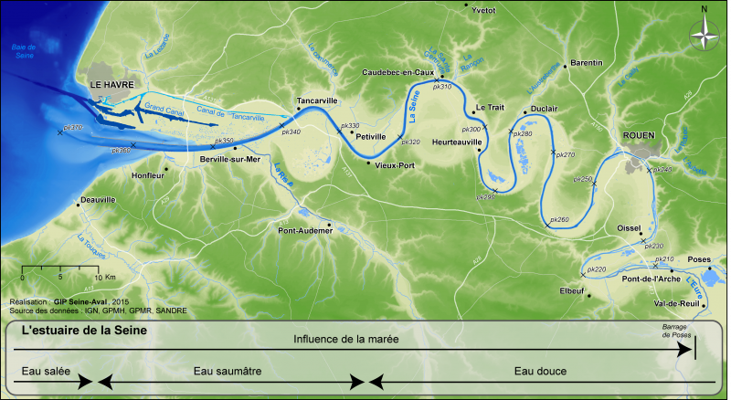
LTSER Zone Atelier Seine - Estuaire de la Seine
Short name
Estuaire de la Seine
Country
France
Web Address
Site Manager
Funding Agency
Site Description
Last modified
2026-06-01 08:22:07
![]()
General Characteristics and Status
Site Status
Operational
Year Established
1995
Observed properties
Affiliation and Network Specific Information
Affiliation
ILTER✔This site is a verified "ILTER" member.
LTER Europe✔This site is a verified "LTER Europe" member.
LTER France✔This site is a verified "LTER France" member.
Photos
Geographic
Centroid/Representative Coordinates
Latitude: 49.469905 Longitude: 0.4676948
Size
ca. 215500.00ha
Elevation (average)
0.00msl
Elevation (min)
-20.00msl
Elevation (max)
20.00msl
Download