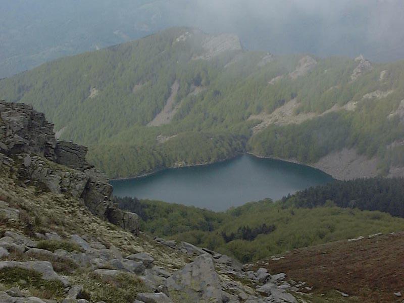
Lago Santo Parmense - Italy

Basic Information
Site Name
Lago Santo Parmense
Short name
IT09-001-A
Country
Italy
Site Manager
Site Description
Lake Santo Parmense is an oligotrophic dimictic lake of glacial-tectonic origin located in the Tuscan-Emilian Apennines National Park at an altitude of 1507 m a.s.l. It is the largest and deepest natural water body in the Northern Apennines, with a surface of 8.2 ha and maximum depth of 22.5 m. The period of ice cover usually lasts from November to May. It was naturally fishless, but underwent regular fish stocking since the beginning of the 20th century. There is a hut (Rifugio CAI Mariotti) on the shore of the lake, including a restaurant, dormitories and meeting room, 220 V power supply (open in summer and on request in other times too). It can also be reached by a chair lift. A small boat is permanently stationed at the lake ...
Show more ...
Last modified
2025-01-07 11:01:56

CC-BY-NC Logo

General Characteristics and Status
Site Status
Operational
Year Established
1952
Observed properties
water parameterecosystem parameterchemical parameterbiological parameterchlorophyllcontentofwaterconductivitywateraciditywateralkalinitywaterdepthwaterlevelwaterqualitywatertransparencycommunitycompositiondiversityindexecosystemstructurespeciescompositionspeciesrichnessammoniumnitrateconcentrationdissolvedorganiccarboninwatersuspendedsolidstotalorganiccarbonnitrogencontentpopulationsize
Affiliation and Network Specific Information
Affiliation
ILTERThis site is a verified "ILTER" member.
LTER EuropeThis site is a verified "LTER Europe" member.
LTER Italia (Italy) (LTER_EU_IT_046)This site is a verified "LTER Italia (Italy)" member.
GERIThis site is a verified "GERI" member.
Photos
View of Lago Santo Parmense from the slopes of Mount Marmagna.
Geographic
100 m
500 ft
Centroid/Representative Coordinates

Latitude: 44.4019 Longitude: 10.0069

Size
ca. 8.20ha
Elevation (average)
1507.00msl
Elevation (min)
1507.00msl
Elevation (max)
1507.00msl
Download

Site information [.json]

Centroid/representative coordinates [.shp] [.kml]
Bounding Box [.shp] [.kml]
Boundaries [.shp] [.kml]