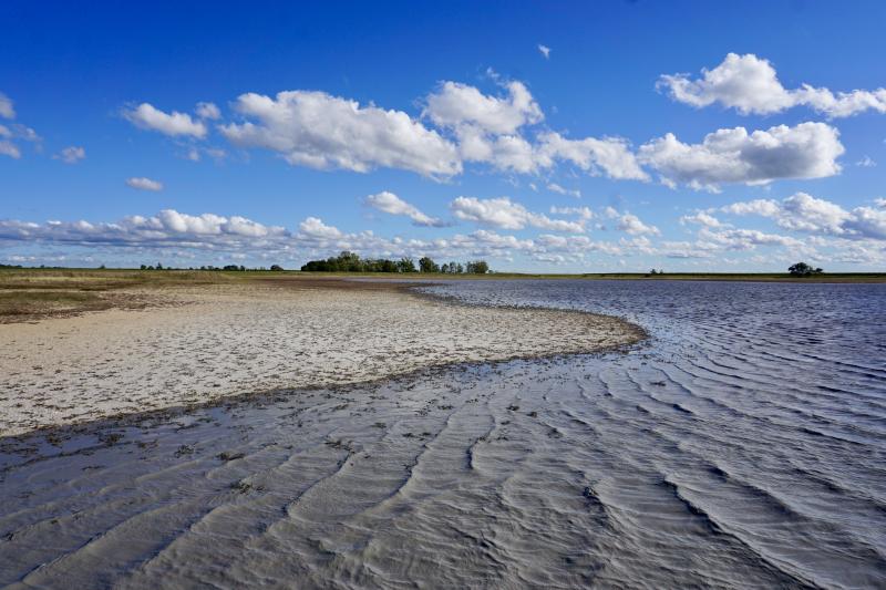
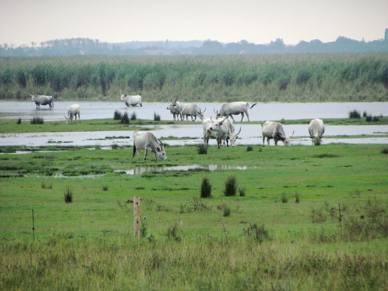
Nationalpark Neusiedler See - Seewinkel - Austria

Basic Information
Site Name
Nationalpark Neusiedler See - Seewinkel
Short name
Nationalpark Neusiedler See - Seewinkel
Country
Austria
Site Description
The Neusiedler See - Seewinkel National Park is the first cross-border National Park in Austria and the first Austrian National Park recognised by the IUCN. It covers in total about 90km² on Austrian territory. About 50% of the area (about 4500 ha) is a Nature Reserve Zone, which remains untouched by humans. This zone is dominated by the southernmost Austrian part of the reed belt from Lake Neusiedl. The Conservation Zones are mainly cultural landscapes and require landscape conservation measures and habitat management like pasturing, mowing, cutting reed or water retention. These measures are taken to preserve the cultural landscape and its biodiversity that has developed over centuries. Important habitats like 160 km² of reed ...
Show more ...
Last modified
2025-01-07 11:01:56

CC-BY-NC Logo

General Characteristics and Status
Site Status
Operational
Year Established
1993
Observed properties
water parameterecosystem parameterbiological parameterconductivitydrylandsalinitygroundwaterlevellakelevellaketemperatureoxygenconcentrationwatercolourwaterdepthwaterlevelwatersalinitywatertemperaturebirdsabundancebirdspresencechangeinpopulationsizeovertimefaunisticdiversityfloristiccompositionfloristicdiversityplantdiversityspecieslistzooplanktonabundancezooplanktonbiomassbiologicaldiversitypopulationdensitypopulationsize
Affiliation and Network Specific Information
Affiliation
LTER EuropeThis site is a verified "LTER Europe" member.
GERIThis site is a verified "GERI" member.
EUROPARCThe affiliation of this site with "EUROPARC" is not verified by the network on DEIMS-SDR.
LTER AustriaThis site is a verified "LTER Austria" member.
Photos
shallow soda lake
shallow soda lake
Geographic
10 km
5 mi
Centroid/Representative Coordinates

Latitude: 47.770772 Longitude: 16.801572

Size
ca. 9000.00ha
Elevation (average)
117.00msl
Elevation (min)
114.00msl
Elevation (max)
120.00msl
Download

Site information [.json]

Centroid/representative coordinates [.shp] [.kml]
Bounding Box [.shp] [.kml]
Boundaries [.shp] [.kml]