Mukhrino field station of Yugra State University - Russian Federation

Basic Information
Site Name
Mukhrino field station of Yugra State University
Short name
Mukhrino FS
Country
Russian Federation
Operating Organisation
Site Description
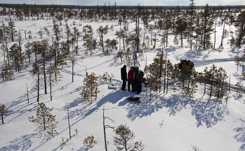
Mukhrino Field Station is owned and run by the UNESCO Chair on Environmental Dynamics and Climate Change at the Yugra State University, Khanty-Mansiysk, Russia. The Mukhrino Field Station is located at the east bank of the Irtysh River near the confluence with the Ob River in the central taiga area of Western Siberia (60°54’ N, 68°42’ E), 30 km south-west of the town of Khanty-Mansiysk (60 000 inhabitants). Due to the severe continental climate, the environmental conditions in the region are comparable with the sub-arctic zone of Northern Europe. The research site is representative for the Western Siberian pristine carbon accumulating peatland ecosystem (“plain mires”). The mires cover c. 60 % of the land surface and can be regarded as important sources/sinks of greenhouse gases and aerosols. The main mire type of the site is raised bogs of the type Pine-dwarf shrubs-bogs (Ryam) characterized by pine trees, Ledum palustre and dwarf shrubs, with areas of Sphagnum fuscum. Interspersed are mires of the type Poor fens (partly drained in the summer) dominated by Carex lasiocarpa and other graminoids, and Sphagnum balticum. Also ridge-hollow complexes, consisting of bog ridges and poor fen hollows are present.
Last modified
2024-10-14 09:10:56

CC-BY-NC Logo

General Characteristics and Status
Site Status
Operational
Year Established
2009
Observed properties
Affiliation and Network Specific Information
Projects
Photos
The micro-meteorological complex in the bog including Eddy Covariance tower and automatic weather station
The Eddy covariance system installation in spring 2015 in the bog
A satelline Internet plate located in the bog to provide Internet connection to research area and the living house
An alternatice energy supply of the experimental area for manipulation of climate in the bog
An automatic chamber of measuring of carbon dioxide fluxes in the bog
Experimental climate manupulation site in the bog using Open top chambers and change of hydrological regime
Manual chambers measuring methan emission from bog soils
Measurements of Sphagnum growth rate
Construction of experimental climate manipulation site in the bog
The alternative power system is located in the bog (solar panels and wind generator) to provide energy to the research are and the living house
The participants of West Siberian Peatlands and Climate Change symposium - 2014 nearby Mukhrino station house
Download

Site information [.json]

Centroid/representative coordinates [.shp] [.kml]
Bounding Box [.shp] [.kml]
Boundaries [.shp] [.kml]