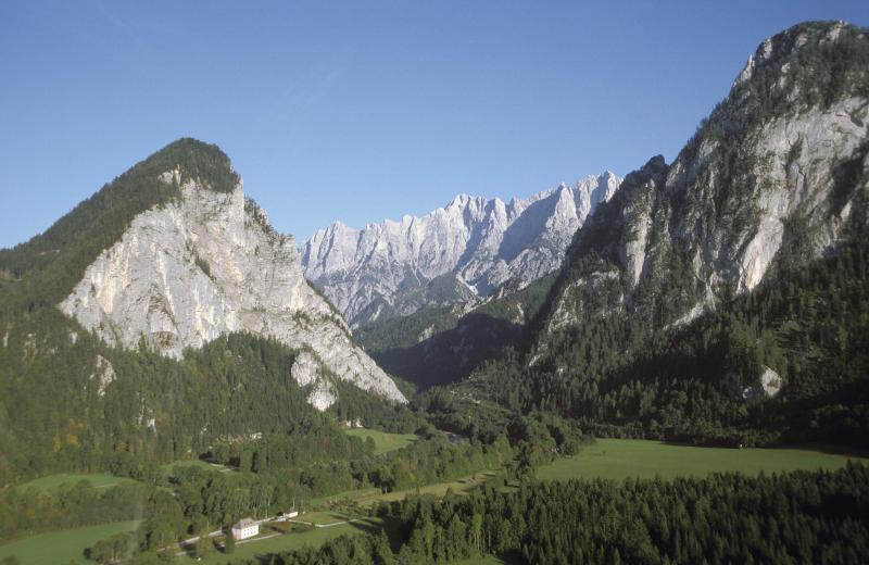
LTSER Platform Eisenwurzen (EW) - Austria

Basic Information
Platform Icon

Site Name
LTSER Platform Eisenwurzen (EW)
Short name
LTSER Eisenwurzen
Country
Austria
Operating Organisation
Site Manager
Site Description
The LTSER platform Eisenwurzen represents both a natural space and a historically developed social and economic area. It does not correspond exactly to federal county borders but extends over 91 municipalities and a total area of 5,904 km2 in the counties of Upper Austria, Lower Austria and Styria. 80 % of the LTSER platform are part of the Northern Alps, 11 % of the area belong to the Northern Alpine Foothills and 9 % belong to the Central Alps. Altitudes range from 167 to 2,515 m a.s.l. The climate type is Continental. Depending on local conditions, annual precipitation values between 730 mm and 2,202 mm are measured. The annual mean temperatures range from -0.8 °C to 9.14 °C. The LTSER Platform Eisenwurzen was established in 2004. A network of already existing institutions (national parks, research centers in the region, etc.) and high-quality documentation (data material) provide good prerequisites for the first Austrian LTSER platform. Research institutions and regional institutions, decision-making bodies and regional management participate actively in the research platform. On one hand, scientists work on sociological and natural science themes in cross-disciplinary teams and in close cooperation with regional populations and their representatives. On the other hand, regional research questions are formulated and – as far as possible - integrated into research agendas. The project results build the basis for sustainable ecosystem management and preservation as well as sustainable regional development. The research projects cover questions of: basic ecosystem research: e.g. at the site Zöbelboden, where long-term monitoring has been carried out into the forest ecosystem on calcareous bedrock.; applied biodiversity and conservation research: e.g. investigation into the impacts of increased forestation upon biodiversity brought about by the retreat of human activity; socio-ecological research: e.g. the Reichraming project, in which a participatively-developed integrated model shows what impacts both internal and external factors have upon material flows, community structure and agriculture;
Last modified
2023-07-21 02:07:14

CC-BY-NC Logo

General Characteristics and Status
Site Status
Operational
Year Established
2004
Observed properties
Affiliation and Network Specific Information
Affiliation
ILTERThis site is a verified "ILTER" member.
Global Observation Research Initiative in Alpine Environments (GLORIA)The affiliation of this site with "Global Observation Research Initiative in Alpine Environments (GLORIA)" is not verified by the network on DEIMS-SDR.
LTER EuropeThis site is a verified "LTER Europe" member.
LTER Austria (LTER_EU_AT_001)This site is a verified "LTER Austria" member.
Photos
Map of LTSER Platform Eisenwurzen
Landscape in Mostviertel
Landscape in National Park Gesaeuse
Basin of Admont
Basin of Admont
Discussion Forum
Discussion Forum
Alp in National Park Gesaeuse
Geographic
Centroid/Representative Coordinates

Latitude: 47.6667 Longitude: 14.5

Elevation (average)
840.00msl
Elevation (min)
167.00msl
Elevation (max)
2515.00msl
Download

Site information [.json]

Centroid/representative coordinates [.shp] [.kml]
Bounding Box [.shp] [.kml]
Boundaries [.shp] [.kml]