LTER Zöbelboden - Austria

Basic Information
Site Name
LTER Zöbelboden
Short name
Zöbelboden
Country
Austria
Operating Organisation
Site Description
The Zöbelboden was established in 1992 as the only Integrated Monitoring station in Austria under the UN Convention on long-range transboundary air pollution (CLRTAP). In 2006 it became part of LTER Austria. The Zöbelboden covers a small forested catchment (90 ha) of a karstic mountain range (500 to 950 m above sea level) in the Kalkalpen National Park. Monitoring and research is focussing on climate change effects on forest ecosystems, the forest carbon and nitrogen cycle, biodiversity, and air pollution effects on forested catchments. The Zöbelboden represents one of the best known karst catchments in Europe with long-term data series of the major components of its ecosystems. The site is part of many national and international monitoring and research networks (ICP Integrated Monitoring, EMEP, LTER, forestREplot, SoilTemp, LifePlan, IG-L, EU NEC-D, etc.). The Zöbelboden is managed by the Environment Agency Austria with technical support of the Kalkalpen National Park and the Austrian Federal Forests.
Last modified
2025-01-07 11:01:56

CC-BY-NC Logo

General Characteristics and Status
Site Status
Operational
Year Established
1992
Observed properties
Climate
Precipitation Sum:    1586 mm
Temperature Mean: 8.06 °C
Standard Reference Period: 1991 - 2020
Affiliation and Network Specific Information
Affiliation
ILTERThis site is a verified "ILTER" member.
ICP Integrated Monitoring (AT01)This site is a verified "ICP Integrated Monitoring" member.
LTER EuropeThis site is a verified "LTER Europe" member.
European Monitoring and Evaluation Programme (EMEP)The affiliation of this site with "European Monitoring and Evaluation Programme (EMEP)" is not verified by the network on DEIMS-SDR.
GERIThis site is a verified "GERI" member.
LTER Austria (LTER_EU_AT_003)This site is a verified "LTER Austria" member.
Recommended Citation
Zöbelboden (1992), Austria. Mountain forest ecosystem in a karst catchment area of the Northern Limestone Alps. Umweltbundesamt GmbH. https://deims.org/8eda49e9-1f4e-4f3e-b58e-e0bb25dc32a6.
Photos
Automatic chamber for soil carbon respiration
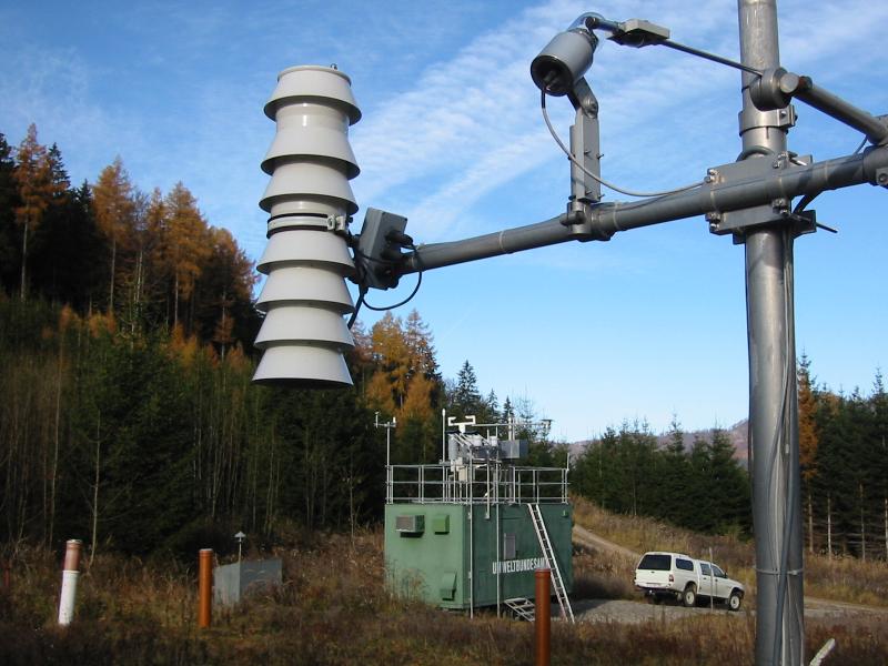
Meteorological and air pollution measurements
Ancient beech forests exist in part of the area
Eddy covariance measurements
Field hut
Field hut
Measuring weir
Measuring weir
forest ground vegetation monitoring
Aerial overview of LTER Zöbelboden
Geographic
Centroid/Representative Coordinates

Latitude: 47.842246069311 Longitude: 14.444136161386

Size
ca. 90.00ha
Elevation (average)
831.00msl
Elevation (min)
516.00msl
Elevation (max)
955.00msl
Download

Site information [.json]

Centroid/representative coordinates [.shp] [.kml]
Bounding Box [.shp] [.kml]
Boundaries [.shp] [.kml]